Dellach im Gailtal
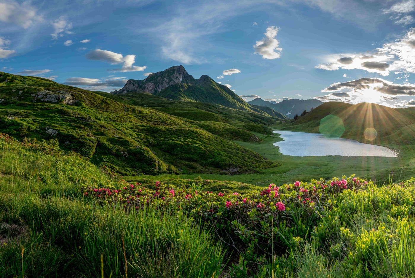
Zollnersee Geotrail – The mysteries of a landscape
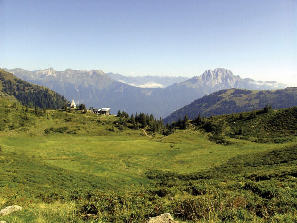
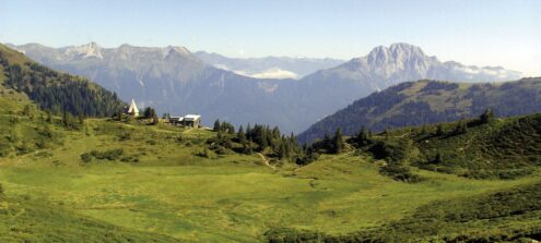
BackThe wonderful alpine landscape to the south of the Zollner Höhe is a paradise for pleasure hikers and families. Easy paths and tracks invite young and old to spend an unforgettable day up here. Lots of small streams and gentle alpine meadows provide plenty of space for children to discover things and let off steam. A trip to the Zollnertörl, where magnificent views of the Italian mountains open up, is not to be missed.
Car: via the B111 Gailtal Bundesstraße to Dellach, turn off towards Weidenburg, and from here take the approach road to the Zollner via the toll-free forest trail
Parking: just before the Zollnersee Hütte
Start of the Geotrail: Zollnersee Hütte
Information
- Difficulty:
- Easy
Moderate - Length:
- 4,4 km
- Min altitude:
- 1715 m
- Max altitude:
- 1817 m
- Difference:
- 210
- Season:
- June - October
- Recommended equipment:
- Hiking boots, functional clothing
Attachments


Information
How to use the map
The interactive altitude map allows you to visualize, on the geographic map, the variation of the altitude of the trail as it develops; drag the map from left to right to see the direction in which the trail must be followed.It is possible to change the size of the zoom by clicking on the buttons in the top left-hand corner, while the center button allows you to restore the initial settings; finally, you can choose a different map by clicking on the button in the upper right-hand corner.
-
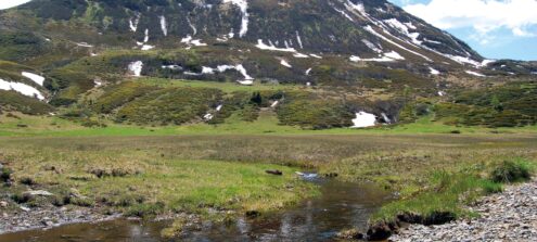
1The moor – a woolly cushion
This site is located on the edge of a moor – a frequently encountered landscape feature in the Zollner region. Moorland is created from an accumulation of peat or dead plants which have not fully decomposed due to constant waterlogging. The impermeable quartz rock below the moor and high levels of rainfall totalling more than 2,000 mm per year are responsible for this waterlogging. Typical moorland plants include peat moss and cotton grass. The products of their decomposition (humic substances) and iron minerals contained within the rock cause the brown colour of the brook. Pollen analyses have shown that there was a lake here some 3,000 years ago which silted up over the years to form the present moorland. When moorland is still being influenced by lake or groundwater, we refer to it as fen. Over time, moorland builds up and becomes a bog. When this happens, the moor only obtains water from precipitation. One of the typical features of this kind of moorland is its domed surface. In places, this moor is more than 2 metres thick and it is in a transitional stage.
-
2Geology and landscape – a plane of ice
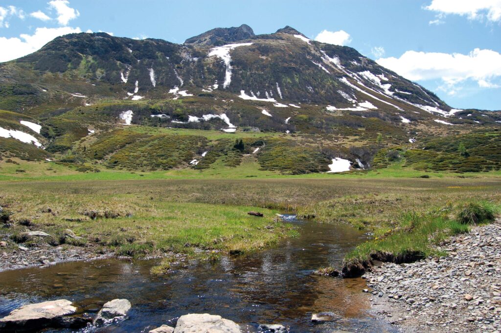
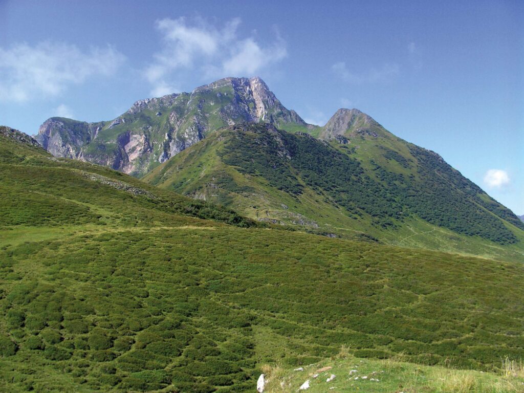
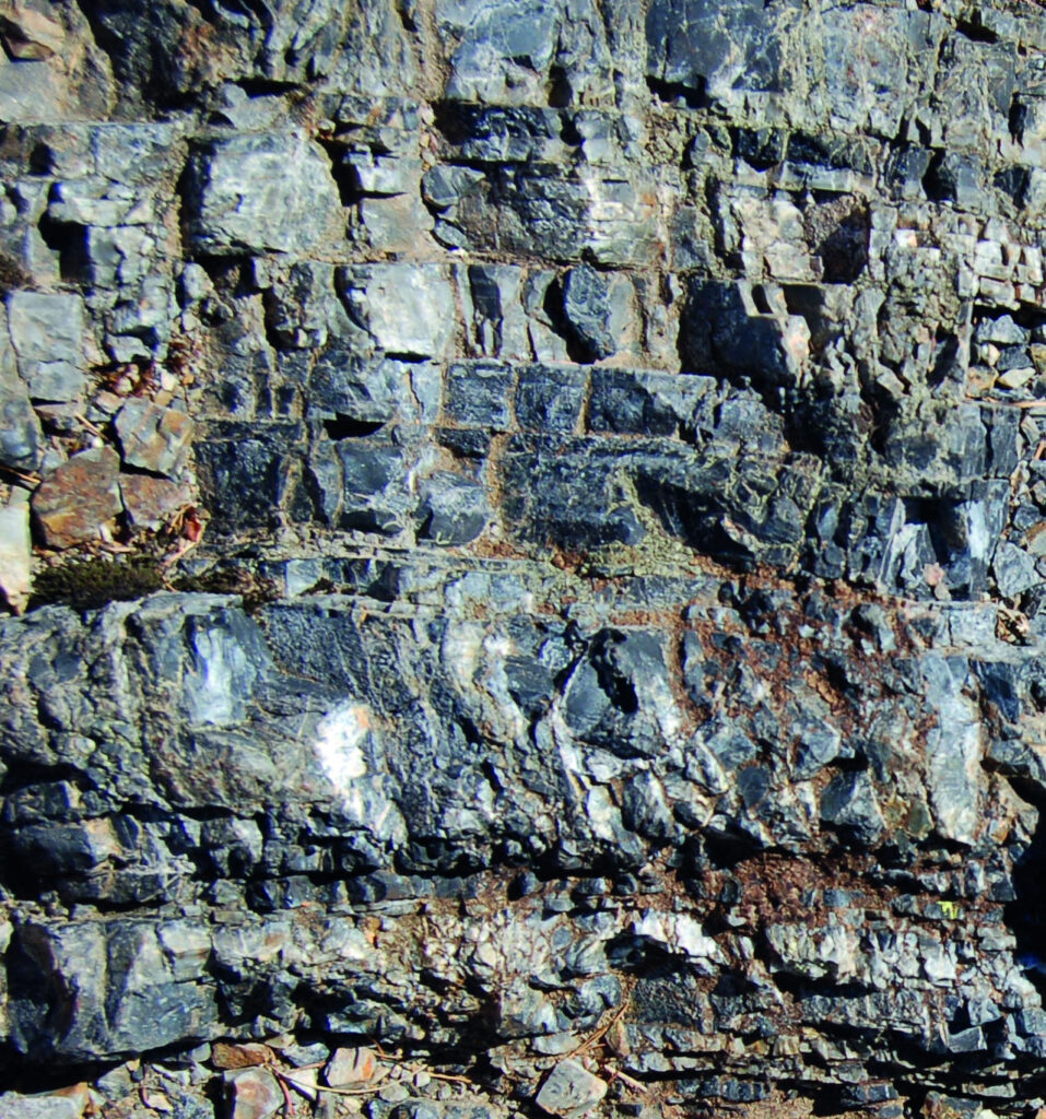
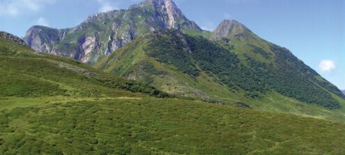
This stopping point impressively shows in all directions just what a significant impact the rock has had on the forms of the landscape. To the south-west, the craggy peak of the Hoher Trieb is prominent and towers high above the hilly pastures. It is composed of limestone while the alpine pastures and the Zollner Höhe to the north-west consist of different shales and sandstones. The latter rocks split more easily due to their slate-like structure, and are therefore more susceptible to weathering than compact limestones. Limestone is eroded less quickly and this explains why these high peaks still remain until today. In addition, a glacier covered the alpine pastures during the last Ice Age up to an altitude of approx. 2,000 m. Only the highest peaks, such as the Kleiner and Hoher Trieb, remained uncovered. These ice masses were not stagnant and moved across the Zollner region, carving out the gently rolling landscape approx. 20,000 years ago with their planing effect.
-
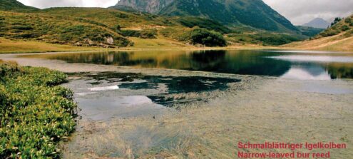
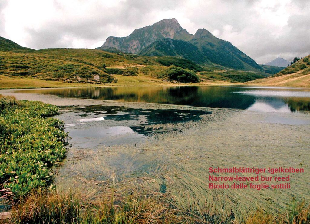
3Lake Zollnersee – a treasure of the landscape with an uncertain future
Lake Zollnersee has the local geology to thank for its formation. The glacier of the last Ice Age carved out a hollow in the shale now underlying the lake. This impermeable black rock prevents the water from seeping away as well as forming the surrounding hills. They are among the oldest in the Lake Zollnersee region, going back some 410 million years. Lake Zollnersee was declared a natural monument in 1985 due to its scenic beauty. However, the siltation process is well underway and the lake is slowly developing into moorland. The lake reaches a maximum depth of 3 m and provides a habitat for rare plants and animals. The presence of the narrow-leaved bur reed and Alpine pondweed should be highlighted. In terms of the animal world, the lake is a popular spawning ground for the Alpine newt.
-
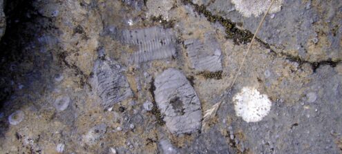
4Limestone plateau – home to tiny organisms
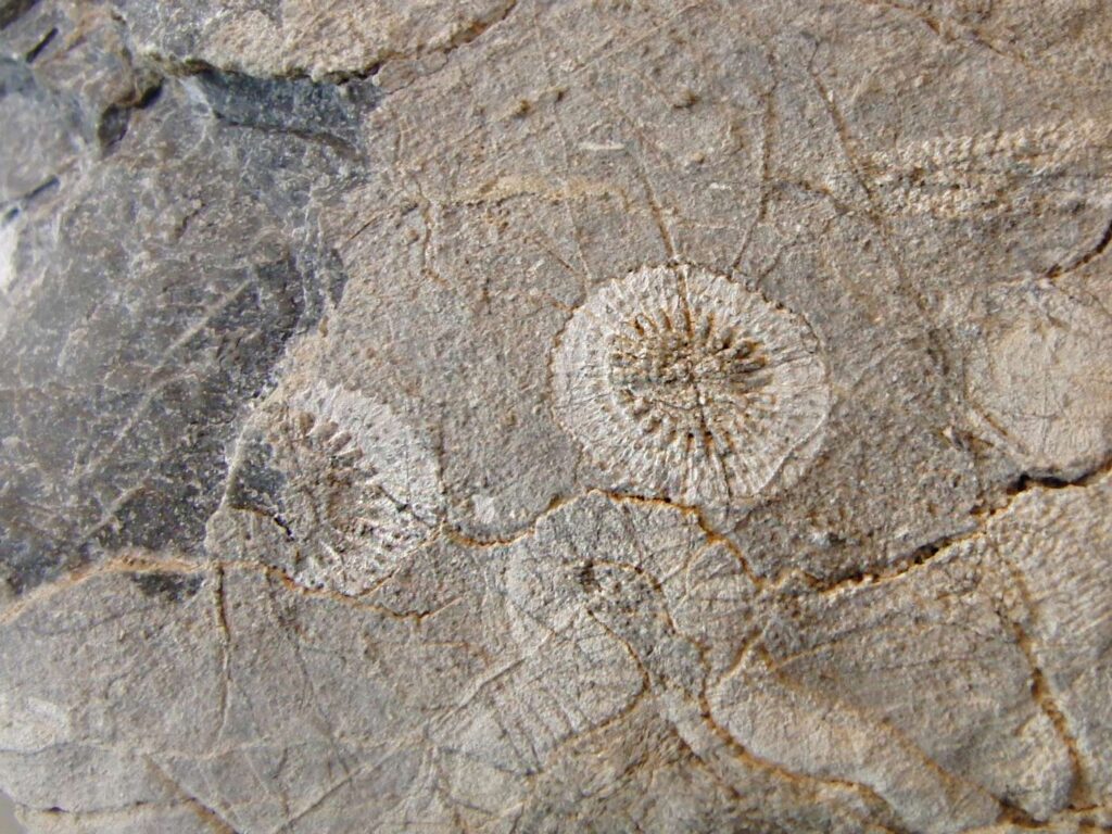
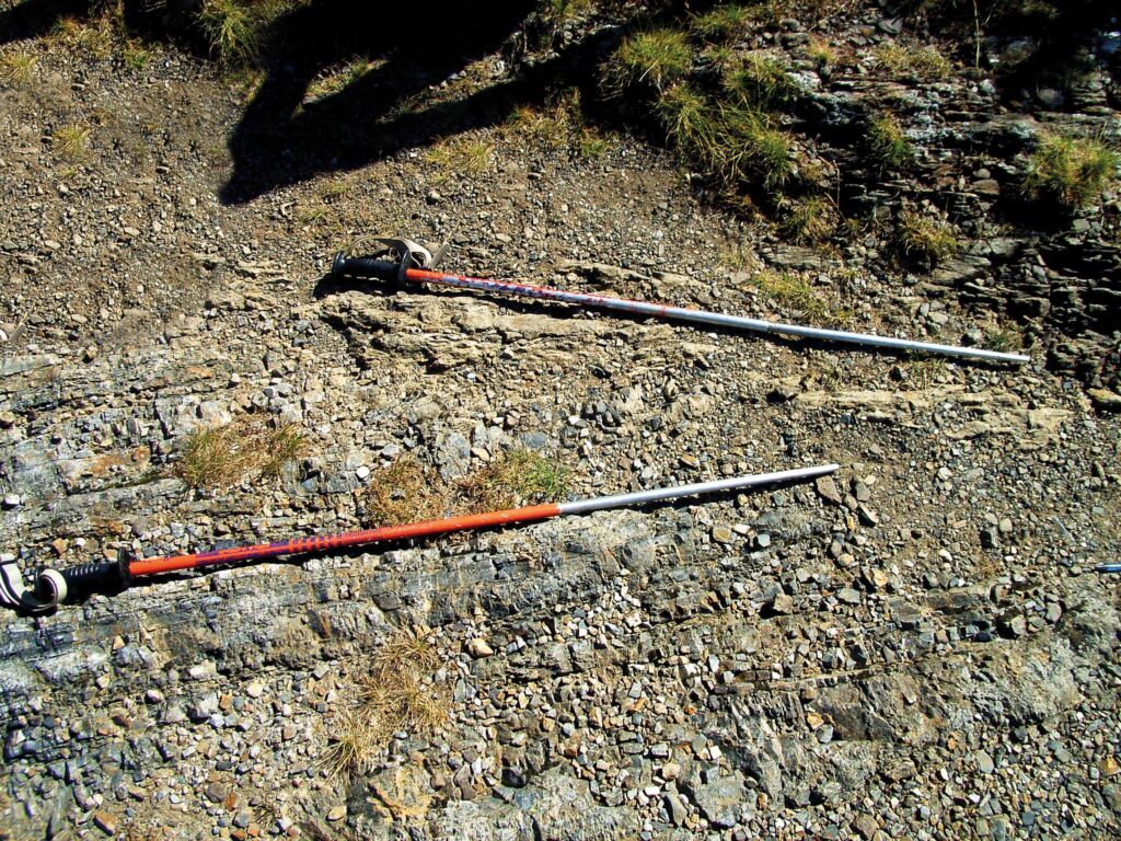
In order to reach the summit of this limestone hill, you first have to climb a gentle slope composed of sandstones and shales. Although completely different, all three rocks belong to one unit – the so-called Auernig Formation. The sequence was formed around 300 million years ago during the Carboniferous Period in a coastal setting and represents the youngest bedrock in the Lake Zollnersee region. During that period, sand was washed from a land area into a shallow sea, where corals, calcareous algae, chambered microorganisms and sea lilies lived. Their calcareous shells and skeletons accumulated on the sea-bottom and gradually built up the fossil-packed limestone plateau we see today. Among the fossils, the remains of the extinct chambered microorganisms named fusulinids dominate, reaching the size of a grain of rice. The same species can be found in the Moscow Basins, suggesting the existence once of a direct seaway between the Carnic Alps and Russia. The occurrence of calcareous algae indicates that the sea was not deep, as these organisms require sunlight for life.
-
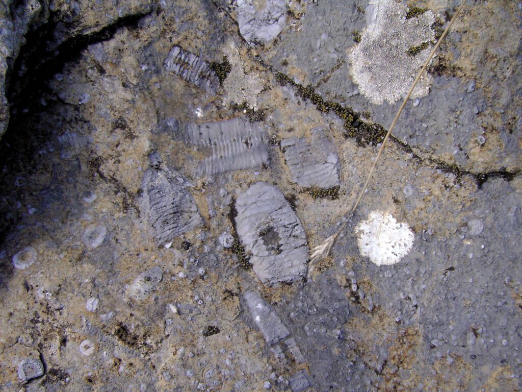
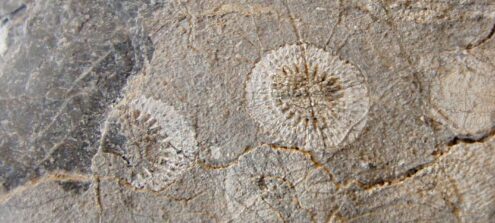
5Limestone plateau – home to flower-like animals
This site too was once part of a continuous limestone plateau which has broken down in the past into three smaller units. Remnants of this former extensive limestone platform can be found between the Zollner and Nassfeld regions. In contrast to the last stopping point, large fossils such as sea lilies or crinoids dominate this locality. Calcareous algae, chambered microorganisms and fossilised snails can also be found in some of the limestone beds. Sea lilies derive their name from their flower-like appearance, but they are in fact animals and still populate our seas today. They are attached to the sea bed by their ‘holdfasts’ (roots). The top end of the stalk is formed by a kind of flower, the so-called crown, from which arms and feather-like tentacles extend to grasp for plankton. The individual parts of the animal’s hard components, which are chalk-based, are held together by a ligament, but fall apart once the animal has died. As a result, it is rare to find complete sea lilies. Usually it is only possible to find parts of the stalk, as is the case here.
-
6The crater – an Ice Age relic
Here you can see a large crater or bowl-shaped form in which moorland has developed. The rounded bowl is almost entirely closed. To the east of the Lake Zollnersee Hut, the brook draining the moorland has carved its way deep into a ridge of bedrock made from hard quartz. The crater-like form, like many others in the Zollner region, developed during the last Ice Age when the glacier carved out the rock below. However, it is not just bedrock which borders this crater. At this stopping point, the terrain flattens out to form a striking terrace, which drops off steeply into the crater after a few metres. This terrace developed during the last Ice Age when the brooks running from the Kleiner Trieb deposited their debris at the edge of the melting glacier. After the ice had melted, a terrace-shaped terrain was left behind. This is a frequent landscape feature in the Gailtal valley and is known as a kame terrace.
-
7Mining – demanding work
Small ‘holes’ in the landscape can be seen here and at other points along the Geotrail. These are mines where iron ore was once mined. The iron deposits are associated with the 360 million year old rocks from the Devonian Period which formed at depths of around 3,000 m. You are actually standing on an old deep sea floor! This hostile sea was home to virtually only spherical radiolarians. Their shells consisted of quartz and were barely one millimetre big. Nevertheless, their skeletons are the source of enormous masses of rock because there were countless radiolarians thriving in the ocean like plankton. Upon their death they accumulated in great masses on the seafloor. The very hard rocks, which consist almost entirely of quartz, can be found in two forms: as compact radiolarite (lydite) and as densely foliated shale.
-
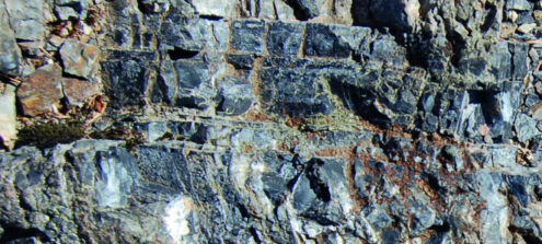
8Old and new mountains – the key to the past
At this stopping point, you will discover the key to understanding the geological evolution of the Carnic Alps, as here the two rock units which built up the Carnic Alps are in close contact. The greyish cherty basal rocks are around 370 million years old. They have been involved in two orogenic events (= mountain building processes). The first, the Variscan, took place in the Carnic Alps around 320 million years ago in the Carboniferous Period. This caused the horizontal deposits of rocks to tilt and fold. Once this turbulent phase had passed, which took some 10 million years, the succeeding rocks were horizontally deposited atop the older rocks, however, at an angle in respect to the older rocks (angular unconformity). Both layers were then involved in the second mountain building event, known as the Alpidic orogeny. The climax of this rock crumpling stage took place around 30 million years ago, and caused the rocks to be tilted again. The mountains we see today were uplifted, creating the imposing landscapes of the Carnic Alps.