Why a Geopark here?
To understand exactly what a geopark is, reference is generally made to the indications provided by the European Geoparks Network, a network recognised also by UNESCO that, to date, unites 69 geoparks in 23 European Countries.
Identikit of a geopark
A European geopark is a territory that possesses a particular geological heritage and a development strategy supported by a suitable European programme to promote such development. It must have well-defined boundaries and an adequate expansion to enable an effective economic development of the area.
EUROPEAN GEOPARKS
www.europeangeoparks.org
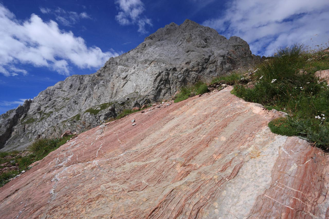
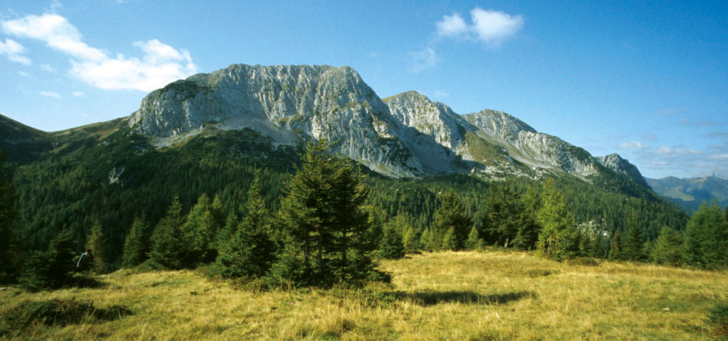
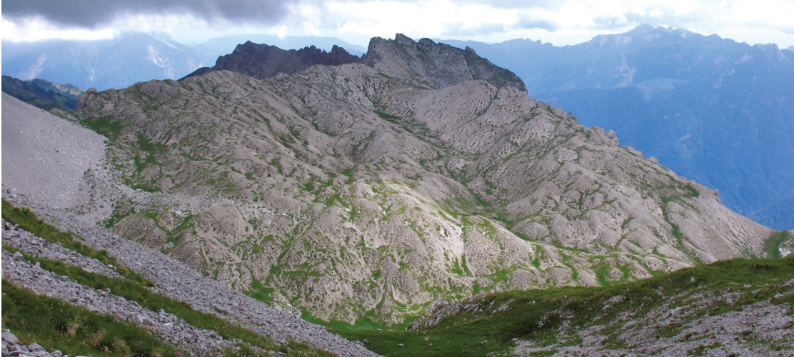
The area of the Transfrontier Geopark of the Carnic Alps possesses geological heritage of the utmost importance, that includes over 130 Geosites, 5 of which are considered to be of international interest (Creta della Chianevate, Chialderate and Monumenz, examples of Devonian limestones, karstification and glacialism; the Devonian cliff of Mount Coglians/Hohe Warte; the alluvial fan of the Rivoli Bianchi (“White Rills”) of Tolmezzo; the platform and basin facies of Mount Pramaggiore; Triassic fish and reptiles of the Preone Valley) as well as many of a high educational value. There are many areas that provide significant connections between geological elements and those of a historical, artistic and cultural nature.
Geological network and management measures
The sites of a European Geopark must be networked and benefit from protection and management measures. A Geopark must be managed by clear, well-defined organisations, capable of reinforcing the protection, enhancement and sustainable integrated development policies of its own territory. The destruction or sale of geological finds taken from a European Geopark shall not be tolerated. In this regard, European Geoparks are managed within the context of the framework established by the certificate of incorporation of the Global Geopark Network.
Most of the area specified as the “core area” of the Transfrontier Geopark of the Carnic Alps falls within the areas protected by the Natura 2000 Network. More specifically, as regards the territory on the Friuli side, the recent regional law n. 15 dated 14th October 2016 issued by the Autonomous Region of Friuli Venezia Giulia, promotes forms of protection and sustainable enhancement of the geological heritage, in addition to the national legislation protecting paleontological heritage.
European Geoparks Network
A European Geopark must work within the European Geoparks Network to further the network’s construction and cohesion. It must work with local enterprises to promote and support the creation of new by-products linked with the geological heritage in a spirit of complementarity with the other European Geoparks Network members.
In the Transfrontier Geopark, the several partners develop coordinated actions to develop a cultural, educational, scientific offer on all levels, to collaborate with the Geoparks Network, but also with those of a museum, cultural and tourist nature that characterise the mountain territory.
Environmental Education
A European Geopark has also to support education on the environment, training and development of scientific research in the various disciplines of the Earth Sciences, enhancement of the natural environment and sustainable development policies.
The coordination of the Geopark with the Friulan Museum of Natural History (scientific advisor of the Geopark), with the CarniaMusei Museum Network, with several Universities, guarantees the development of scientific research throughout the territory.
Active role played in development
A European Geopark plays an active role in the economic development of its territory by means of the enhancement of the general image associated with the geological heritage and the development of geotourism. A European Geopark has a direct impact on the territory and it has a positive influence on the environment and on its inhabitants’ living conditions. The objective is to enable the residents to reclaim the ownership of the values of the territorial heritage and to actively participate in the cultural revitalisation of the territory.
The activities of the Transfrontier Geopark of the Carnic Alps include the development of a network of geological itineraries, that, based on the Italian Alpine Club routes as well as those of the Österreichischer Alpenverein (a guarantee of clarity of the itineraries and the maintenance of the paths), proposes routes of an increasing degree of difficulty and journey times, that make it possible for excursionists to admire, observe and further explore the geological history of the area. These are itineraries that can be downloaded by the most popular devices in use and are also available in a printed version, for the precise choice of not creating excessive superstructures (the use of billboards and signs is reduced to a minimum). In addition to the geological itineraries, there is a calendar of guided excursions, educational activities e informative events, held outdoors as in the visitor centres and museums in the local area.