Timau (Municipality of Paluzza)
The source and the caves of the Fontanon
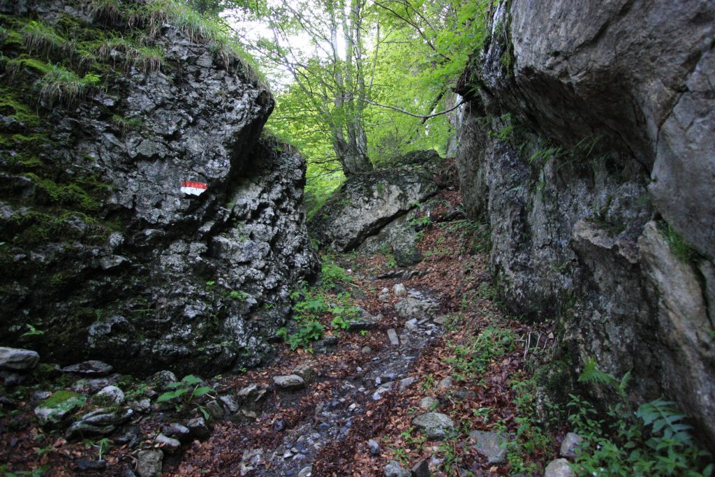
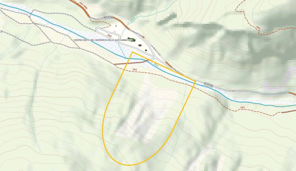
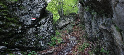
BackThis geo-excursion lets the observer examine the karst phenomena that characterize the limestone outcrops of the Alta Valle (upper valley) of the Bût torrent. The itinerary also leads to the karst source of the Fontanon and to one of the caves that form the complex subterranean system of the mountain overlooking the village of Timau.
The route starts from the last houses of Timau, on towards Passo di Monte Croce Carnico (a car can be left in the layby just beyond the bridge leading to the Ossuary Temple). After taking the CAI path 402, along the way, making two small detours, you reach the karst source of the Fontanon and an initial cave in the underground system of the Timau Caves. The route first extends along the outcrops of pale limestone rocks formed in the warm seas of the Devonian (410-360 million years ago), before then intercepting the more recent outcrops of the Hochwipfel Formation dating back to the Upper Carboniferous (310-300 million years ago). The route ends at the Geopark Visitor Centre at Laghetti di Timau, an exhibition facility open to the public during the summer months.
It is advisable to leave the car at the Visitor Centre or, to return to the village, take the cycle path that leads above the Visitor Centre and almost on to the source of the Fontanon, avoiding a stretch of state road in the tunnel.
Information
- Difficulty:
- Moderate
- Length:
- 4,7 km
- Min altitude:
- 841 m asl
- Max altitude:
- 1289 m asl
- Difference:
- 490 m
- Season:
- April - November
- Recommended equipment:
- Hiking boots and equipment
Attachments


Information
info@geoparcoalpicarniche.org
+39 0433 487726
Tolmezzo (UD) – ITALY
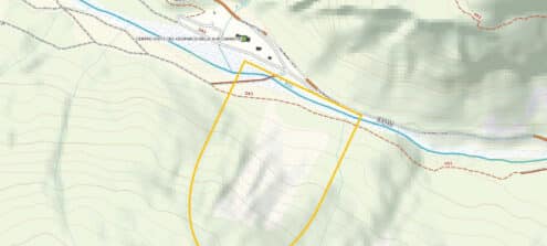
How to use the map
The interactive altitude map allows you to visualize, on the geographic map, the variation of the altitude of the trail as it develops; drag the map from left to right to see the direction in which the trail must be followed.It is possible to change the size of the zoom by clicking on the buttons in the top left-hand corner, while the center button allows you to restore the initial settings; finally, you can choose a different map by clicking on the button in the upper right-hand corner.
-
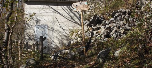
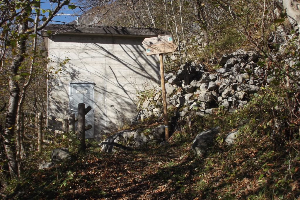
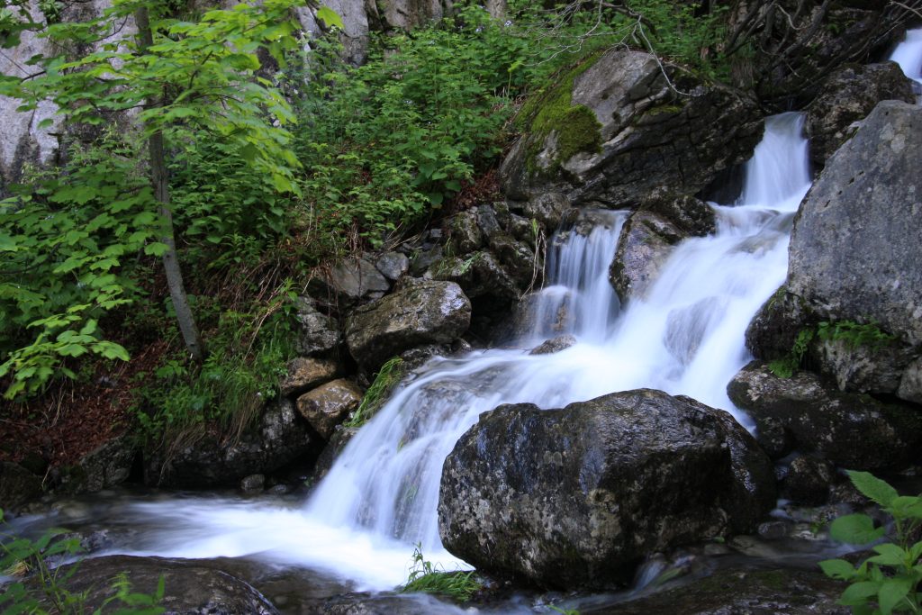
1Captation of the Source of the Fontanon di Timau
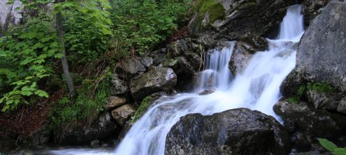
Along the CAI path no. 420, near the aqueduct building, a detour to the left leads to the source of the Fontanon di Timau, a Geosite of regional importance. This is a powerful perennial karst spring and has been known since Roman times. Today its waters are used to generate hydroelectricity and, in part, for the mains supply. The maximum flow rate may exceed 5,000 litres per second and the waters that feed the source also come from the limestones of Monte Coglians. The water flows from several mouths that open in the rocky wall at the base of the Creta di Timau before forming a short but steep stream that flows over the boulders of the morainic deposits that are partially cemented together by travertine deposits.
-

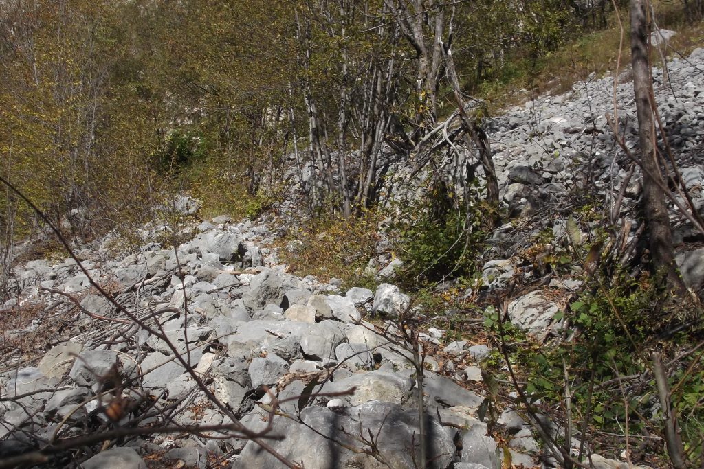
2Glacial debris deposits
Back on the main path and before reaching the rockface of Monte Gamspitz, going up to the right, you come across a scree that partly covers mainly morainic deposits. The large amounts of debris are linked to the presence of tectonic lines. In the area between the path and the nearby Fontanon spring, a morainic deposit emerges that dates back to the late Würmian (the last phase of the Quaternary glaciations).
-
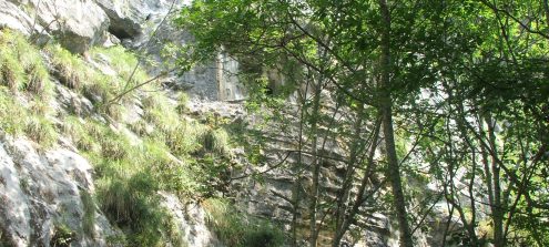
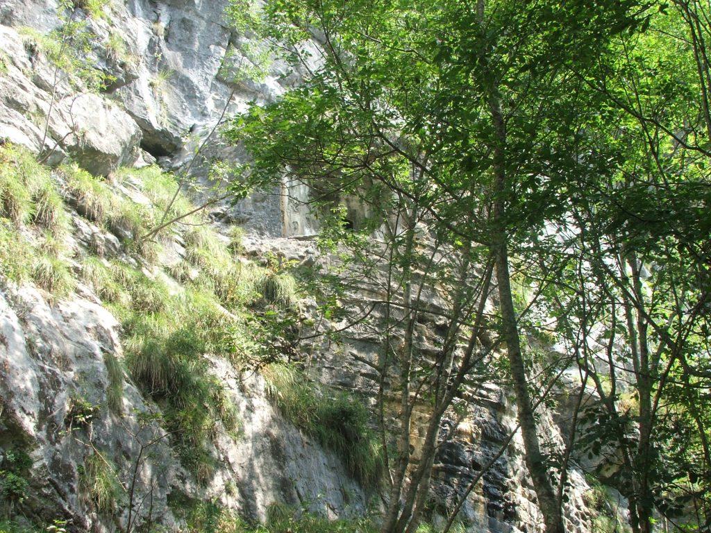
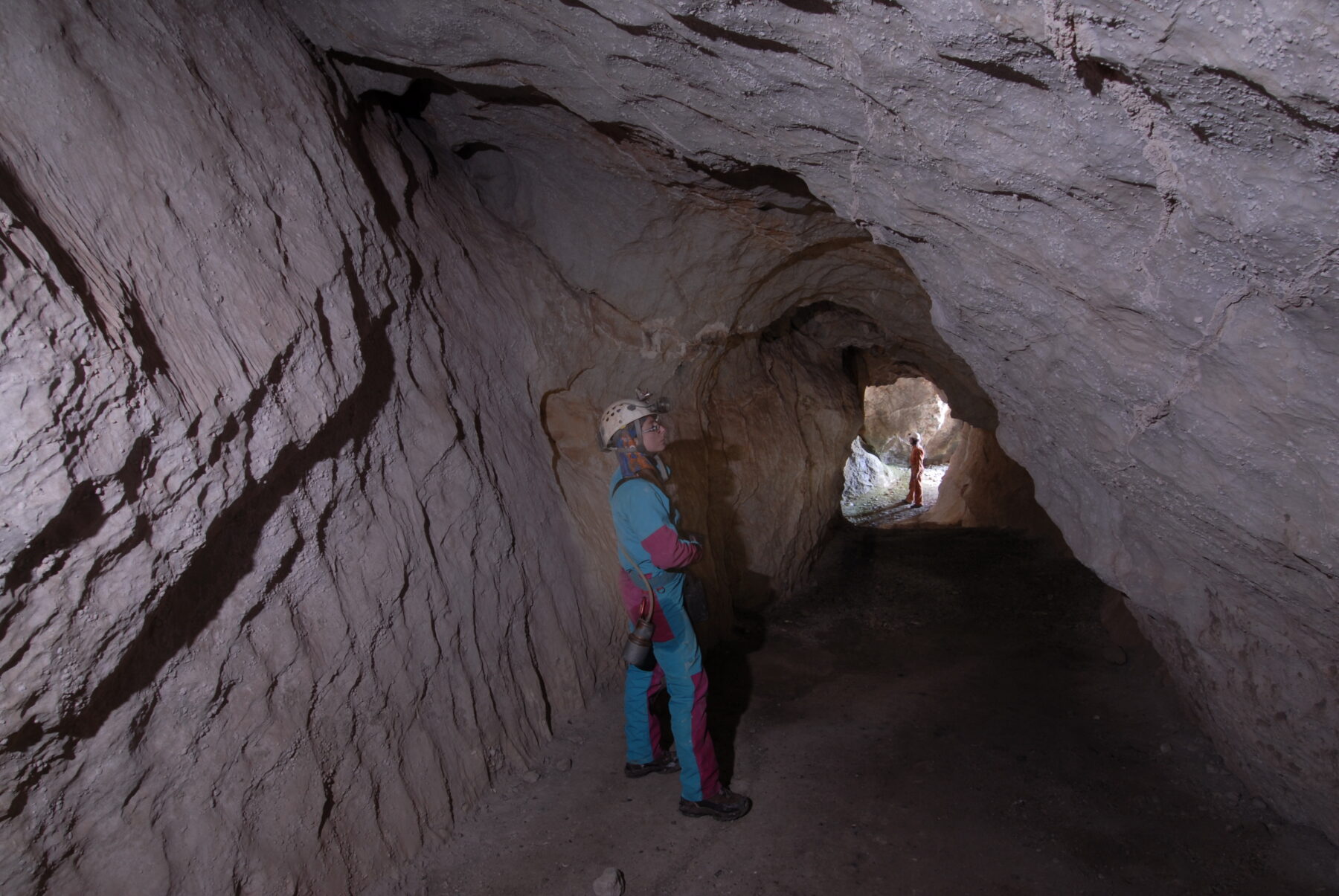
3Entrance to the underground system of the Timau Caves
Continuing the path along the vertical wall of Monte Gamspitz you reach a detour to the right that leads to the entrance to one of the cavities that go to make up the karst system of the Timau Caves. This system develops on several levels in rocky masses made up of limestone rocks that have undergone karst dissolution by the infiltration of waters that are particularly aggressive because they are rich in CO2 and which flow both on the surface and at depth, giving rise to tunnels, pot-holes and sinkholes. Although partly equipped for visits, only the initial sections, which also show evident signs of work for defensive purposes, can be walked independently with a torch. For the remainder you must be accompanied by speleologists or expert guides.
-
4The Hochwipfel Formation
From the point where the path curves towards the north-east, the itinerary leaves the massive, pale limestones of the Devonian and continues within the Hochwipfel Formation, made up here of outcrops of easily-flaking, dark shales and siltstones. These rocks were formed during the Lower Carboniferous, a period characterized by strong tectonic movements that led to sinking of some areas and the uplifting of others. Much of the material deposited by the rivers in this period was the result of the erosion of the emergent lands and subsequent submarine landslides. The Hochwipfel Formation is almost devoid of fossils, except for plant remains.
-
5The torrential incision of the Rio Gaier
Here the route crosses the Rio Gaier (in the locality named Ponte sul Gaier). The erosive action of the stream on the dark, stratified rocks of the Hochwipfel Formation is evident. These rocks are more erodible than limestones and in some places the torrent’s incision takes the shape of the gorge.
-
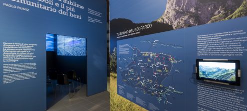
6The Visitor Centre of the Carnic Alps Geopark
Once you reach the SS52bis you arrive at the Geopark Visitor Centre in the locality named “Laghetti”. This locality owes its name to the ancient presence of a palaeo-lake in the area upstream of the town of Timau, the origin of which was linked to the presence of postglacial landslides. During the summer the Visitor Centre is open to the public and offers an opportunity to discover other geo-paleontological features that characterize the upper course of the valley of the Bût torrent.
-
7Masareit landslide
Beyond the Visitor Centre, the Masareit landslide is clearly visible on the right, affecting the northern slope of Monte Terzo and the effects of which extend to the Bût Torrent, in the area of Laghetti. It is thought that the collapse of the rocky slope, involving about six million cubic metres of material, was triggered after the retreat of the ice masses that descended along the valley and the consequent rapid easing of the glacial pressure on the mountainside. The last glacial tongue to occupy the Bût valley dates back to about 15,000 years ago. In the 1980s, as a result of ongoing subsidence, it was necessary to refurbish the SS52bis, work which seems to have stopped all movement of the landslide.