Gorges
A gorge (also called canyon) is a narrow valley carved into the rock, between steep, if not vertical, walls. The erosion that creates a gorge is mainly due to mechanical action, that is, the dragging down of materials by the watercourse, which wear away the side walls. Where faulting phenomena occur, or in areas subject to karst phenomena, with – for example – cave collapses, the formation of these gorges is frequent.
Gorges can also arise in areas corresponding to confluence steps, caused by the modeling of glaciers, where a minor glacier once joined to a main one with a greater erosive capacity. In this case, when the ice melts, the hanging side valley undergoes accelerated erosion by the watercourse that runs through it, initially forming a waterfall and then evolving through the deepening of the gorge.
To get some idea
Some examples of gorges in the area of the Geopark
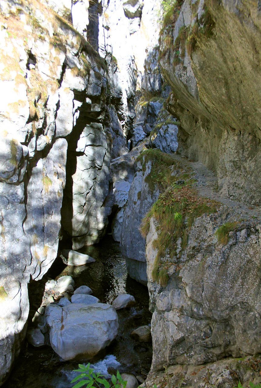
The Buse dai Pagans gorge
Cavazzo Carnico, Area: Tolmezzo Prealps and Val Tagliamento
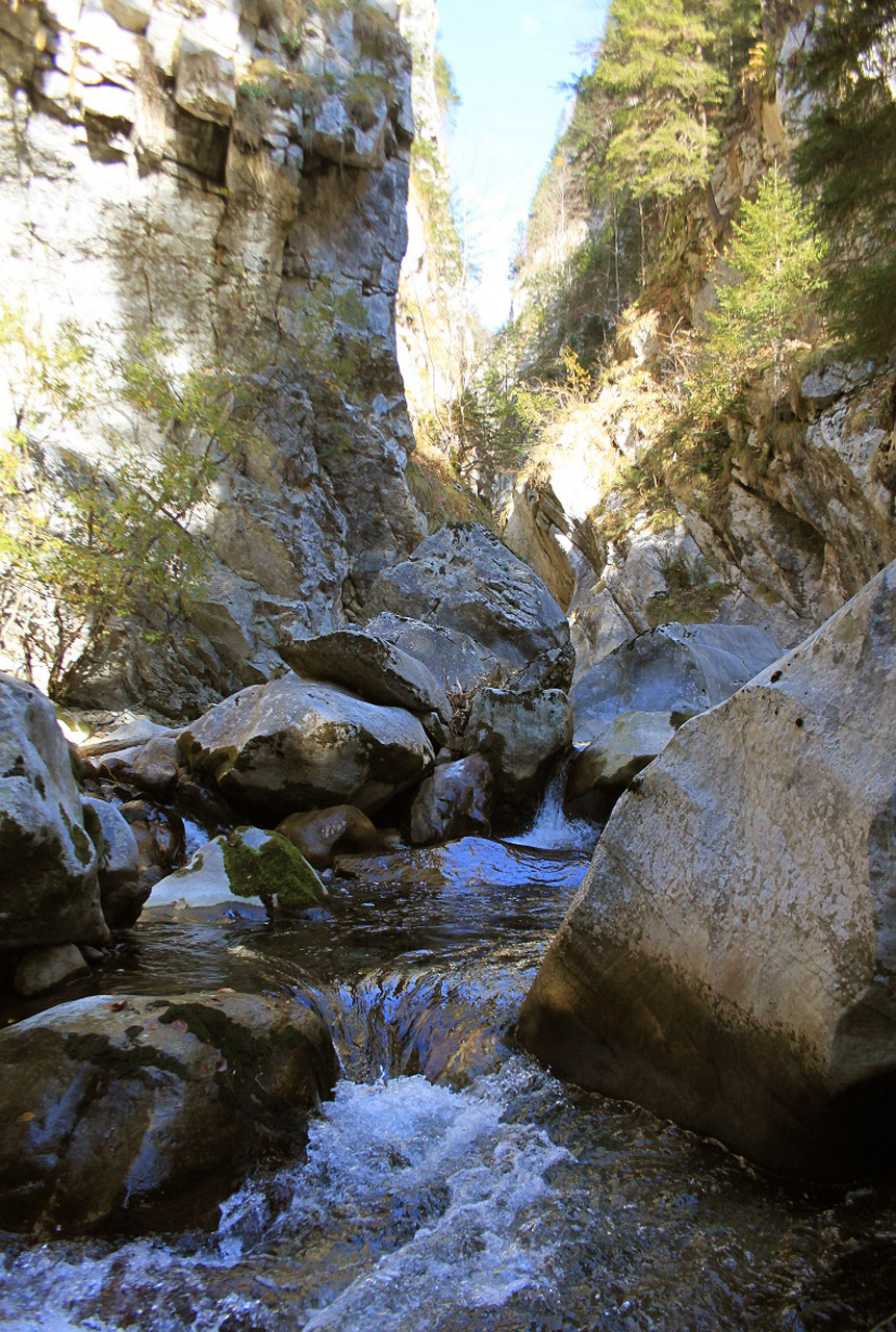
The Buse dai Pagans is a narrow gorge carved by the Rio Cianevutte. The entrance is a few metres upstream of the river that you cross to reach the Chianevate cave, initially a difficult route among the boulders. This is a passage about 3 metres wide, dominated by walls about thirty metres high. Entering, you reach a wide point in the gorge with a large boulder in the middle of the gravel bed. After a further twenty metres in the gorge closes with a circular space, at the end of which runs a small waterfall about 15 metres high.
The gorge continues uphill with successive falls and other phenomena caused by fluvial erosion, ending up on the Falnor Plateau towards Cesclans. This stretch, however, can only be explored starting from above and by using speleological techniques.
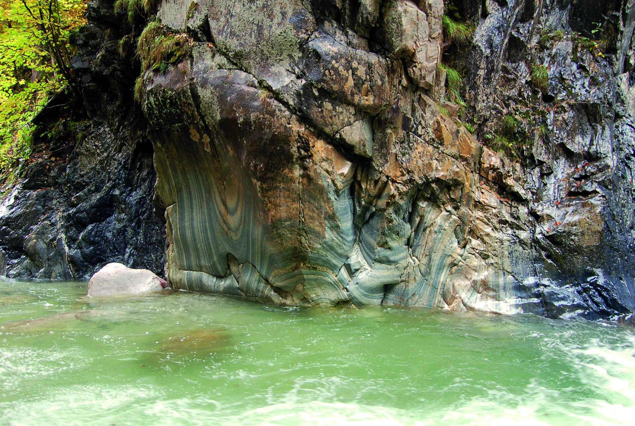
Vinadia gorge
Villa Santina / Lauco. Area: Prealps of Tolmezzo and Val Tagliamento
The Vinadia gorge is the result of the erosive action of three rivers: the Chiantone, the Pichions and the Rio Vinadia itself which, at the end of its impetuous run, flows into the Tagliamento. Almost at the intersection of the three waterways and not far from the road that leads from Vinaio to Buttea, flanked by an evocative waterfall, rises the imposing base of what was a curious natural phenomenon, a stone tower of considerable size, that unfortunately collapsed quite recently. The gorge is carved into dolomite and dolomitic limestones belonging to the Schlern Dolomite formation (Middle-Upper Triassic). Only in a limited portion, immediately downstream of Vinaio, does the riverbed cut into the well-stratified dark limestones alternating with marls in thin layers belonging to the upper Triassic. The canyon walls are often well polished by the river’s erosive action. The typical fluvial-torrential morphologies are present, widespread and well represented. We encounter waterfalls and jumps, pools and meanders in rock, potholes and undercuts, which outline the evolution of the hydrographic network, with a progressive lowering of its actual altitude. The itinerary within the gorge is a continuous succession of waterfalls, pools and stretches flanked by rocky walls so close together that you cannot see the sky from the bottom.
Along the route, partly equipped with a via ferrata, expert speleologists can visit a cave, which is accessed through an artificial tunnel.
The Vinadia gorge is a geological site of regional interest. (see Geosites)
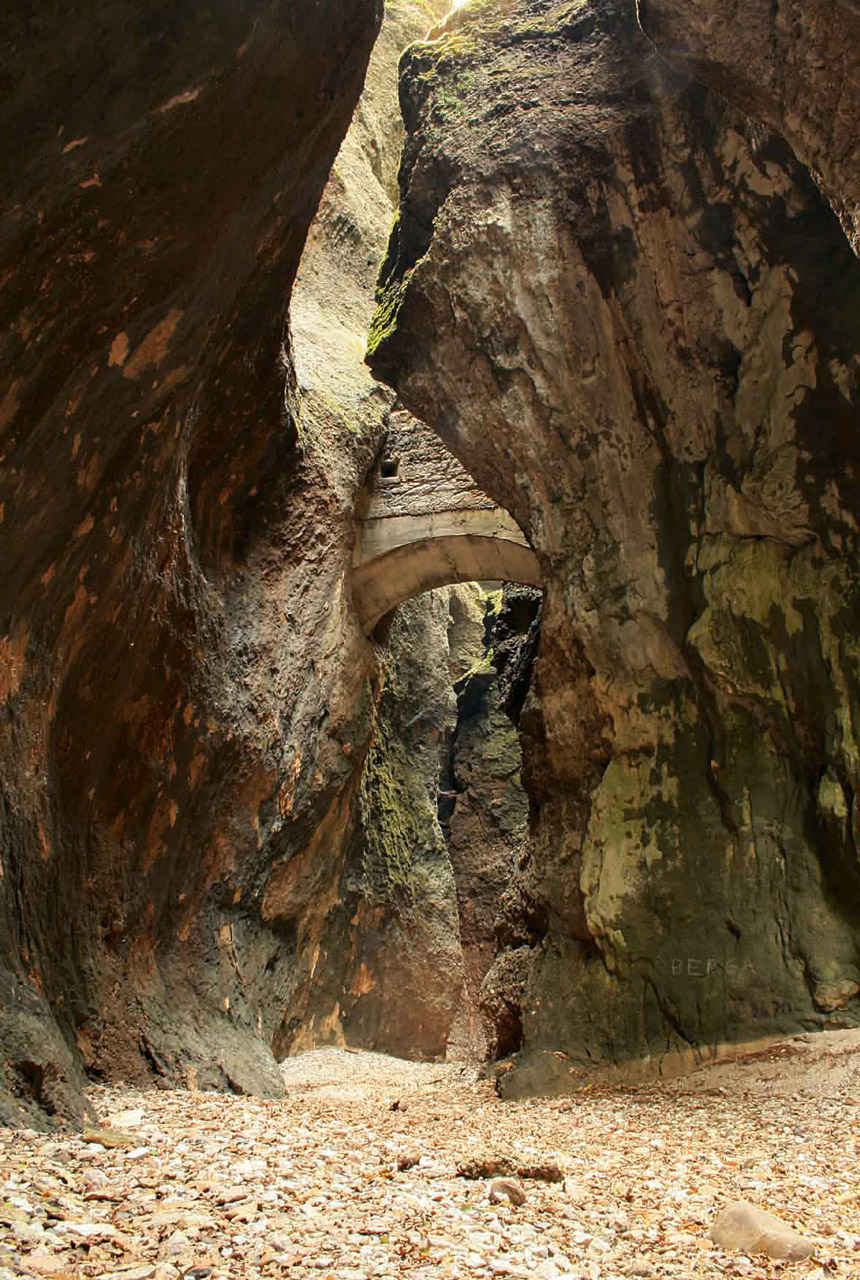
Forra Las Calas
Paularo. Area:Western Carnic Alps
The Las Calas gorge is a natural monument carved out of the rock by water, which has polished it, creating evocative scenes. But it is not only the water that is the protagonist of this gorge. In fact, along the way we can observe the result of the enormous forces in action during the two orogenies, the Hercynian and the Alpine, and the crustal deformations that subsequently shaped the outcropping rocks. In addition, the lithological differences, which characterize the Devonian-carboniferous stratigraphic succession, carved by the Chiarsò Torrent, give rise to an environment of considerable interest from a geological perspective.
Go to Geotrails to download the Geotrail Las Calas (route, geological contents, .gpx files) or download the free app GeotrAC!

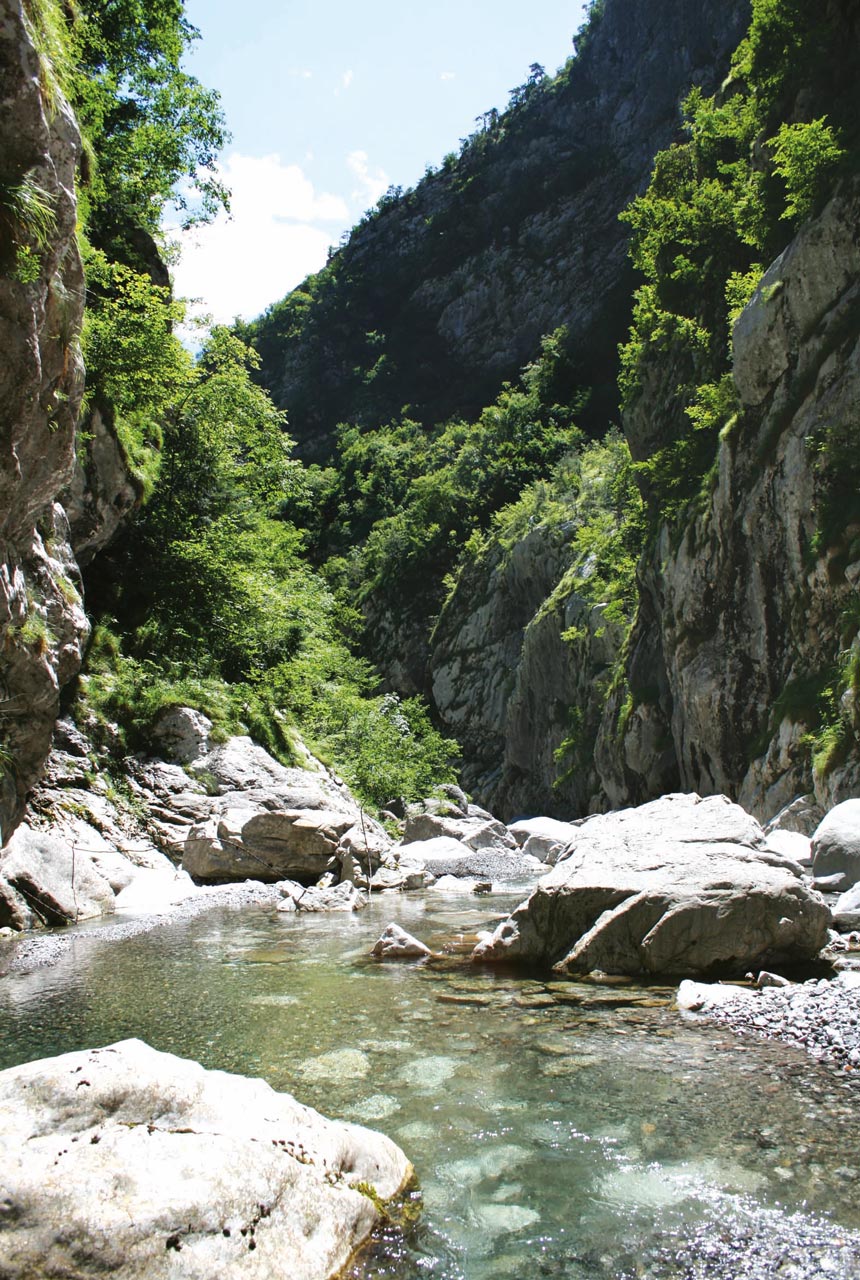
The Lumiei gorge
Ampezzo / Sauris. Area: Prealps of the Val Tagliamento and Tolmezzo
This develops downstream of the artificial basin of Sauris, created in 1948 (the year of the inauguration of the Maina dam) for the production of hydroelectric energy. The gorge is probably set along lines of tectonic discontinuity and crosses the banks of Ladinian-Carnian dolomite and dolomitic limestone. From the bridge over the Lumiei you can see the passage between the terrestrial deposits, among which the layers of green tuffs from the Ladinic and dolomites stand out.
The dolomite formation is deeply incised and is affected by a dense series of sub-vertical faults running North-South.
The Lumiei gorge is a geological site of regional interest (see Geosites).
Garnitzenklamm
Möderndorf. Area: Gail Valley
This is a deep gorge carved into the rock by the Garnitzen stream and runs for a length of about 4.5 km. The gorge owes its origin partly to a fault zone that has provided the runoff water with less resistance than the surrounding rock formations, and partly because of the melting of the glaciers of the last Ice Age, the Würmian, as a result of which powerful mixed streams with rocky material have contributed to eroding the slopes (“exaration” is the term that defines the shaping action caused by a glacier on the surrounding rocky walls). The gorge is passable and is also the destination of a Geotrail (see Geotrails). 4 km long, it has a drop of about 500 metres. The entire route is very demanding and reserved for experts with a guide. It is possible, however, to cover only a part of it.