Forni Avoltri
Bordaglia: signs of orogenesis and glaciations
BackThe route allows you to reach sites of great beauty, such as the Alpine lake of Bordaglia, and to take in the evident signs left by the Hercynian and Alpine Orogenies and by the erosive action of glaciers in the landscape. Part of the route runs along a set of faults, which together constitute the Val Bordaglia Line, a geosite of regional importance.
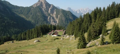
The geotrail starts from Pierabech (Forni Avoltri). Once you have taken the CAI (Italian Alpine Club) path 141, it drops down towards a small bridge over the Degano torrent. After crossing the stream, ascend the slope until you cross the forest road that leads to the Casera Bordaglia di Sotto. In the event that the bridge is not passable, the walker will need to proceed (for about 750 m) along the road to the marble quarry and, immediately after the quarry itself, to take the forest track on the left that leads to the Casera Bordaglia di Sotto.
From the Casera Bordaglia di Sopra you can choose one of two different routes, either continuing to the left along the CAI path 142 along which you reach the ‘Pera’ lake directly or going straight, following the path 142a, you arrive at the junction for the Giramondo Pass from where, again along the CAI path 142, you cross the scree under the Creta di Bordaglia, thus reaching the lake mentioned above.
From the Pera lake continue towards Sella Sissanis, Casera Sissanis di Sopra and Sissanis di Sotto. From here, take the forest track that drops down to the Fleons gorge (‘stretta’) and back to the starting point.
Information
- Difficulty:
- For expert hikers only
- Length:
- 13 km
- Difference:
- 1130 m
- Season:
- June- September Attrezzatura consigliata: Scarponi o scarpe da trekking robuste con suola scolpita; abbigliamento per escursioni in quota, pranzo al sacco e acqua. Consigliati bastoncini da trekking e impermeabile
- Recommended equipment:
- Hiking boots, technical equipement, water, food. Thunderstorms are frequent in the afternoons.
Attachments


How to use the map
The interactive altitude map allows you to visualize, on the geographic map, the variation of the altitude of the trail as it develops; drag the map from left to right to see the direction in which the trail must be followed.It is possible to change the size of the zoom by clicking on the buttons in the top left-hand corner, while the center button allows you to restore the initial settings; finally, you can choose a different map by clicking on the button in the upper right-hand corner.
-
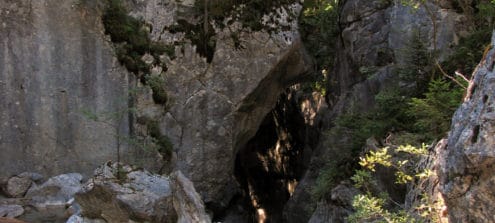
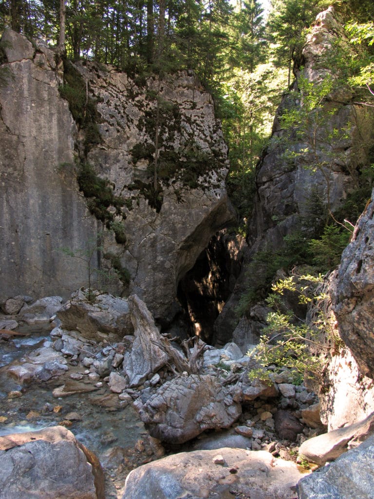
1The Small gorge of the Rio Bordaglia
In its final stretch the Rio Bordaglia has carved out a small gorge. The erosion that has deepened the course of the stream has affected the compact marbles originating from metamorphosed Devonian limestones. At this point you can observe certain morphologies that characterize these environments, such as erosion pots and rocks smoothed by the water.
-
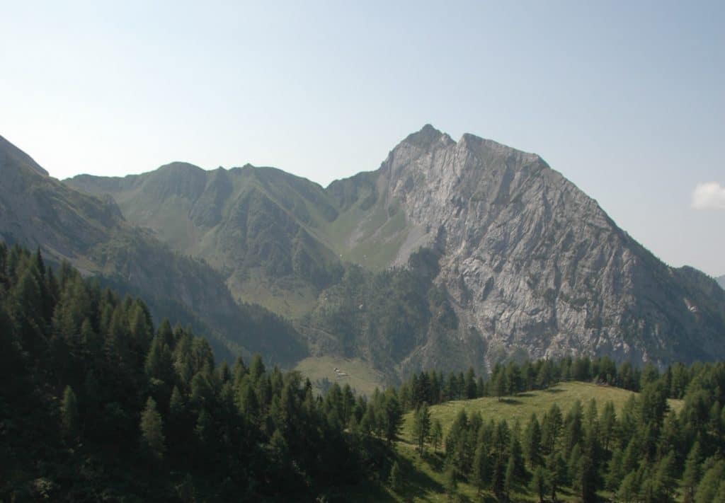
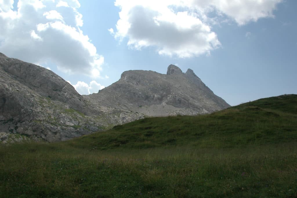
2Folds in Monte Vas
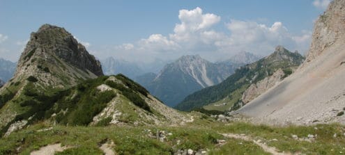
From the Casera Bordaglia di Sotto, looking south, you can see the reliefs that form the southern side of the Val Bordaglia, that include Monte Vas (on the right) and Cima Ombladet (on the left). The side of Monte Vas has large asymmetrical folds. The direction of their axes leads them to compressions running north-east – south-west dating back to the Eocene and Lower Oligocene.
-

3Cima Ombladet
From the Casera Bordaglia di Sotto, looking south, you can see Monte Vas and Cima Ombladet. Cima Ombladet features the Zollner (Lower Devonian - Lower Carboniferous) and Hochwipfel (Carboniferous) Formations consisting of dark rocks. Their morphology is softer and covered with vegetation. The underlying Formation of the massive limestones of Monte Coglians (Lower to Upper Devonian) gives rise to bare rock walls, light grey in colour.
-
4The Val Bordaglia Line
The Casera Bordaglia di Sopra is located within the area of the “Val Bordaglia Line”, a geosite covering an area 750m wide and 2.5km long, that extends as far as Passo Giramondo. This is a bundle of fractures involving rocks formed from the Devonian to the Middle Triassic. As a result of various movements that occurred along the faults during the Alpine Orogeny, in some cases these rocks were compressed to a thickness of just a few metres.
-
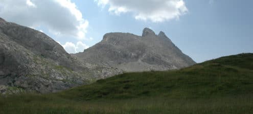
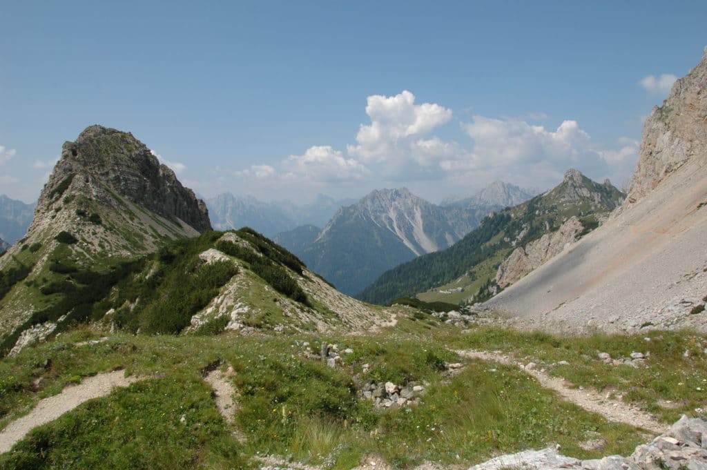
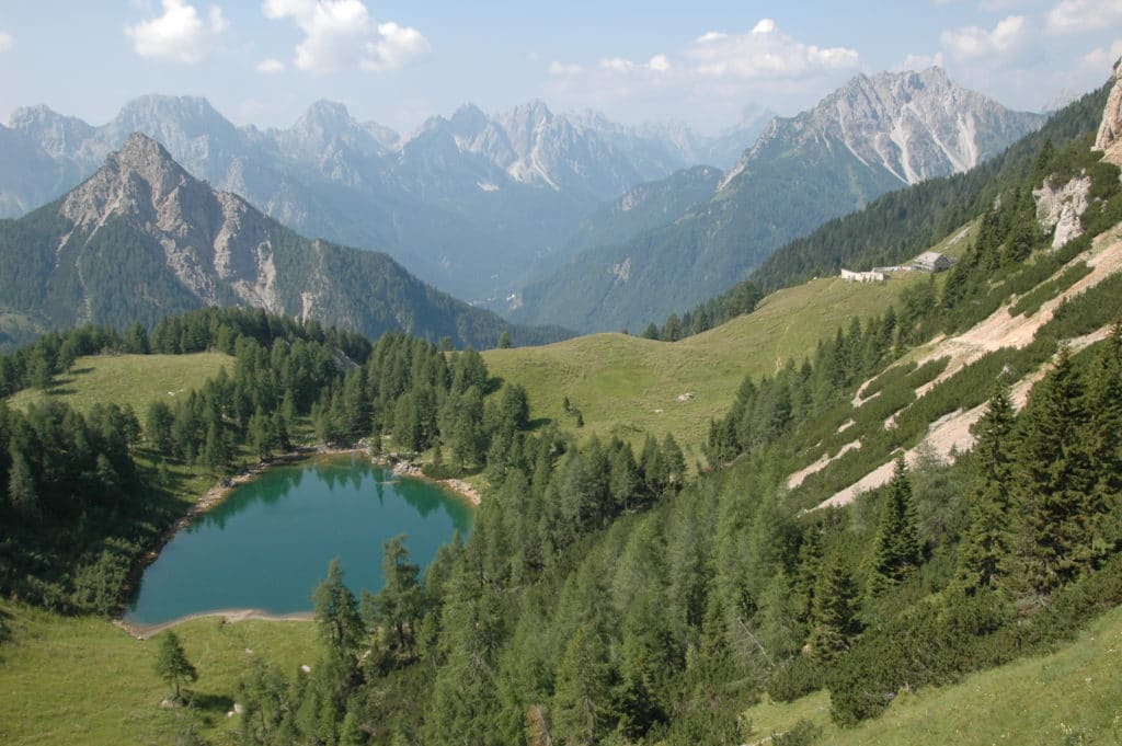
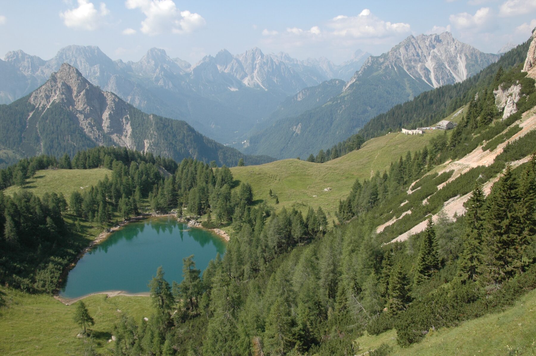
5Monti Volaia, Cogliàns and the Creta di Chianevate
From this point, looking east, a panoramic view opens up towards the Monte Volaia group, Cogliàns and the Creta di Chianevate. These reliefs are made up of platform limestones dating back to the Devonian (420-360 million years ago) and constitute the nucleus of the most imposing Palaeozoic organogenic reef visible in Europe today. This structure is made up of clusters of the skeletal remains of organisms welded to each other. It developed over about 25 million years, in areas of warm, shallow and well-oxygenated seas. The gradual lowering of the seabed allowed the growth of generations of organisms that formed a reef over 1 km thick, about 5 km broad and almost 100 km long.
-
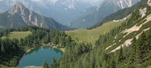
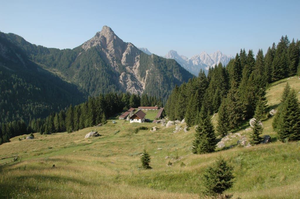
6The Lake of Bordaglia
The Lake of Bordaglia is a small stretch of water that occupies a basin of glacial origin, elongated along a line running north-east - south-west, the same as the bundle of faults featured in the Val Bordaglia Line. The lake can be reached from the Casera Bordaglia di Sopra by going down a detour on the right.
-
7Monte Navastolt and the Hercynian Metamorphites of Monte Avanza
From Casera Sissanis di Sopra you can see Monte Navastolt which represents the easternmost part of the Monte Avanza group. This area, unique in the Region, is made up only of metamorphic rocks. The metamorphosis of these rocks began 350 million years ago with the initial compressions of the Hercynian Orogeny.
-
8The Stretta di Fleons
The Stretta di Fleons is a deep gorge carved by the turbulent waters of the Degano torrent as it runs between the eastern slope of Monte Navastolt and the western one of Navagiust. This too, like the gorge on the Rio Bordaglia, is set within the metamorphosed marbles derived from massive Devonian limestones, although here the incision made by the stream is deeper. In addition to the erosion pots and smooth rocks there are some jumps and small waterfalls.