Tolmezzo
Rivoli Bianchi debris flow
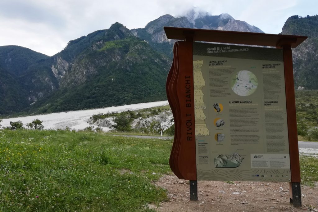
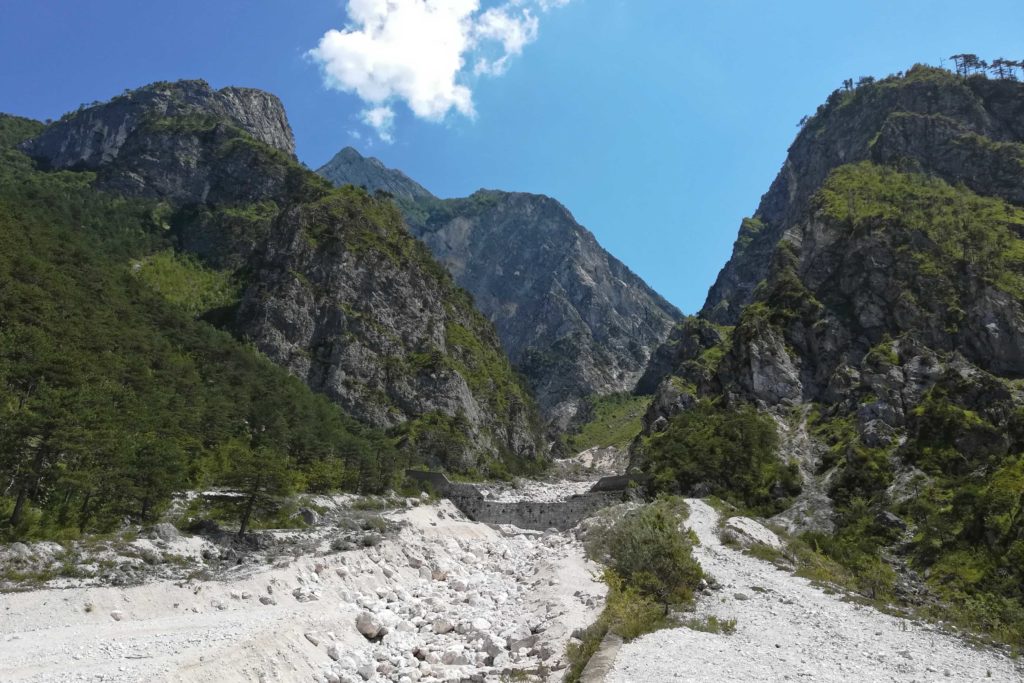
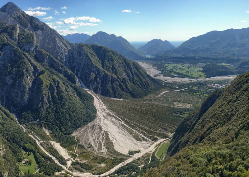
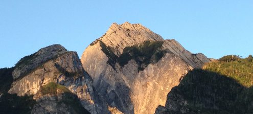
BackWe are in a site whose name already says a lot: the “Rivoli Bianchi”, in fact, is the fan of debris that opens before us, at the foot of Mount Amariana, descending from the deep fracture through which the Rio Citate flows. Its scientific name is “alluvial cone”, and what we are facing is one of the largest active cones in Europe!
From here a tourist itinerary starts.
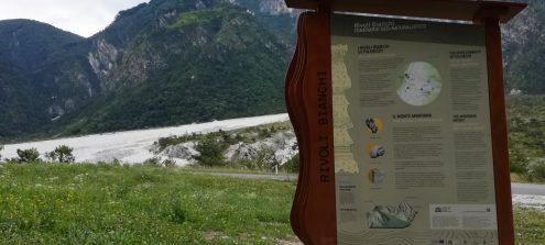
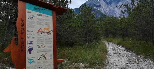
In about 1 hour and 30 minutes and with the help of explanatory panels, we can explore this extraordinary environment and know its geological history, which makes this area a site of international interest, the flora and the fauna that settled here and the interventions made by man to control the flow of debris.
In the return section, the .gpx track of the route is only indicative because the path could be slightly modified, due to possible new debris flows.
Information
- Difficulty:
- Moderate
- Season:
- All year
- Recommended equipment:
- Trekking shoes
Attachments


How to use the map
The interactive altitude map allows you to visualize, on the geographic map, the variation of the altitude of the trail as it develops; drag the map from left to right to see the direction in which the trail must be followed.It is possible to change the size of the zoom by clicking on the buttons in the top left-hand corner, while the center button allows you to restore the initial settings; finally, you can choose a different map by clicking on the button in the upper right-hand corner.
-
1Rivoli Bianchi debris flow and Mount Amariana
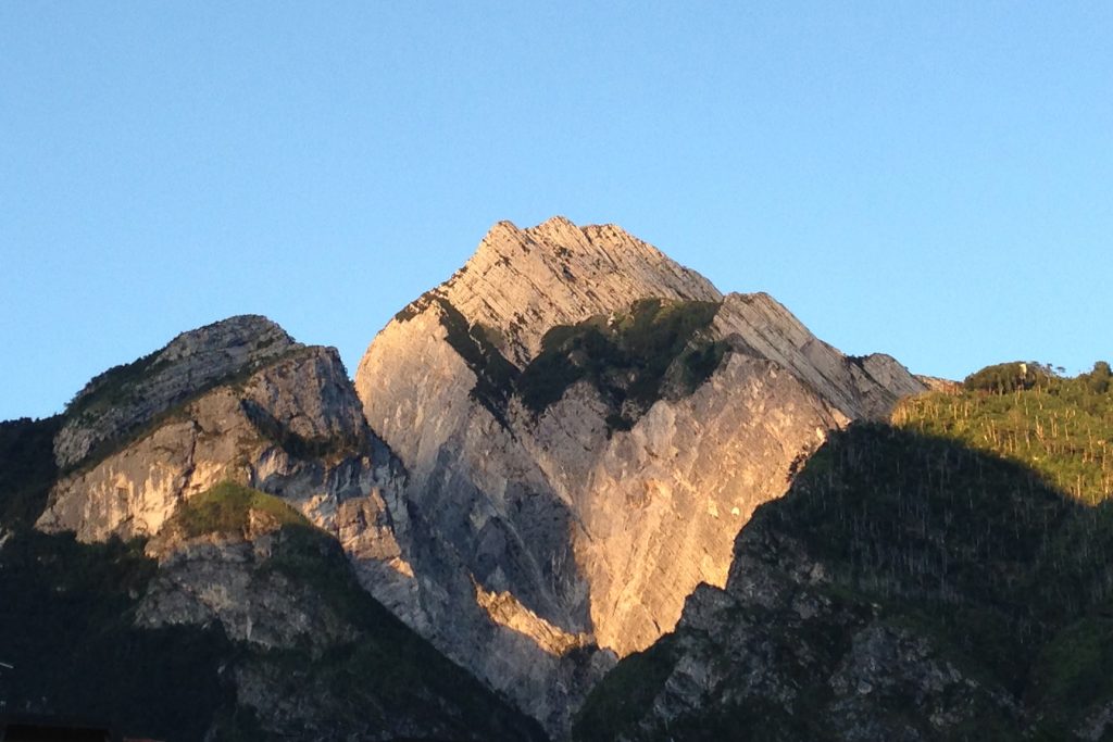
In front of us we observe the large accumulation of debris at the base of Mount Amariana: it is one of the largest active alluvial cones in Europe. A cone is a body of debris that is formed when a stream, which first flows into a narrow valley, flows into a wider and lower slope. It is exactly what happens at the Rio Citate, which actually runs through the Amariana's fault.
On a first glance at Mount Amariana we notice the stratified rocks and the ones piled on top of the other for almost 1000 meters. It is mainly Main Dolomite dating back to the end of the Triassic, 225-210 million years ago. Then a sea spread over this area, in some phases deeper, in others similar to a lagoon in which algal carpets developed. This alternation is visible today in the different superimposed layers of crystalline dolomia, formed by deep sea sediments, and dolomia with stromatolites, derived instead from the mud retained by the algal carpets. -
2The Amariana fold and the alluvial cone
The rock layers that form Mount Amariana deposited in a marine environment, during the Triassic. Subsequently, with the Alpine orogeny, these layers have deformed, creating a huge fold that affects the entire relief. Today the fold is more difficult to decipher with the naked eye, because of successive faults: vertical fractures that have dismantled it, transposing the sections, like in a puzzle whose pieces do not fit perfectly anymore and yet make possible to understand the whole picture. The most evident fault supplies the alluvial cone material through the steep gorge of Rio Citate.
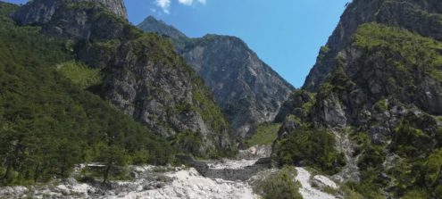
The Rivoli Bianchi cone is made of material that has accumulated over the last 18,000 years, after the disappearance of the glacial tongues that covered the area. Its surface is over 2 km2, with a maximum difference in level of about 200 m. -
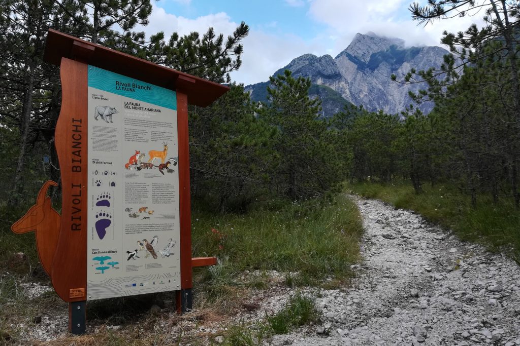
3The fauna in the Mount Amariana area
Plants typical of scree environments have stabilized the debris in this part of the alluvial fan, where they could consequently develop. The area surrounding the Amariana cone shows different environments: from screes to pine and beech woods, from cliffs to prairies. For this reason, this territory is home to a fauna consisting of both species typical of woods and screes.
The information panel will provide a quick show of the main species living in this area (English on the back side!). -
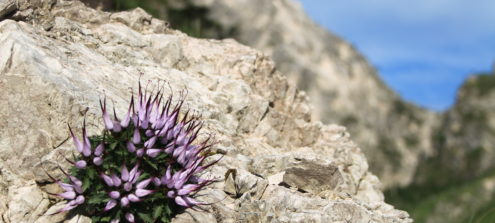
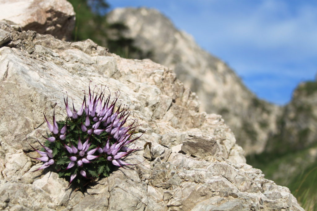
4The scree flora
From a botanical point of view, the detrital cone represents a very interesting natural habitat. In fact, it is an environment generally hostile to life; nevertheless, some species manage to colonize it, adapting in a surprising way to a soil poor in nutrients and even modifying it, making it more suitable for other species to grow. These plants are called pioneer plants, because they are the first to settle in a soil, or glareophytes, that is they adapted to live on the scree.
The information panel in front of you will provide a quick show of the main species living in this area. -
5The weirs
Since the end of the 19th century, protecting the road and the ancient railway (no more existing), as well as the land of the underlying plain, from the flows of the Rivoli Bianchi was considered of primary importance. The government commission that studied the debris flow (1904) underestimated the power of the debris flows. Geologists were left on the line-slides. In 1905, a powerful storm caused one of the major floods reported up to that time. Geologist Michele Gortani produced one of the most extensive studies on the area, concluding that “we should let the Rio Citate run at will” without channeling it and just preventing its floods from reaching the road of the countryside.
In the Twenties of the 20th century several containing and correction weirs, a detour bank and a barrier weir were created. More recent interventions and corrections have affected the Rio Citate and Rio Cornons’ riverbeds. -
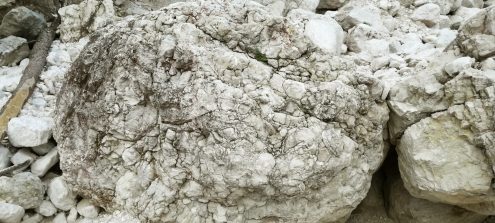
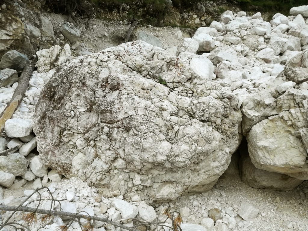
6Fossils of Mount Amariana
Once arrived on the detour bank of Rio Citate, you begin to walk down the cone. Note: in the return section, the .gpx track is only indicative because the path could be slightly modified, due to possible new debris flows.
At the end of the detour bank, you can cross the basin of Rio Citate to get to a big rock on the other side: it is rich in Megalodon fossils. You can recognize these shellfish fossils from their heart-shaped section.