Paularo
The “Las Calas” Gorge
BackThe Las Calas gorge is a natural monument carved out of the rock by water, which has polished it, creating evocative scenes. But it is not only the water that is the protagonist of this Geotrail. In fact, along the way we can observe the result of the enormous forces in action during the two orogenies, the Hercynian and the Alpine, and the crustal deformations that subsequently shaped the outcropping rocks. In addition, the lithological differences, which characterize the Devonian-carboniferous stratigraphic succession, carved by the Chiarsò Torrent, give rise to an environment of considerable interest from a geological perspective.
To reach the start of the route from the town of Paularo, follow the signs for Cason di Lanza until you reach the locality “da Nelut”, where you can park. From here, following the paved road towards Cason di Lanza. after a few tens of metres you arrive at the beginning of the CAI path n. 442. Having reached the riverbed, a short detour to the left leads to an observation point over a stretch of gorge. Returning to the main circular route, skirt the Chiarsò, proceeding upstream until you reach the path carved into the rock that runs along the gorge. At the exit of the gorge the path goes back up into the woods, until you it reaches the paved road that leads back to the starting point.
-
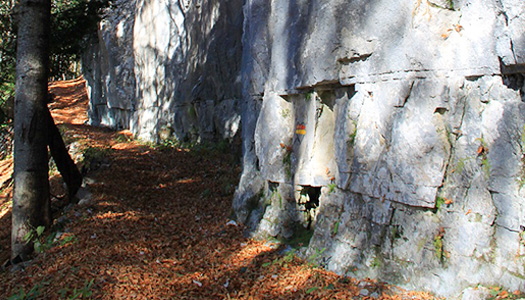
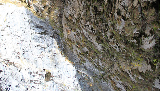
1Vertical rock wall
While descending towards the mouth of the gorge, pay attention to the vertical wall of rock that you can observe upstream, to your left. It consists of pelagic limestones (and thus deposited in a marine environment) dating back to the end of the Devonian or the beginning of the Carboniferous period (between approximately 380 to 350 million years ago).
-
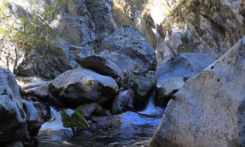
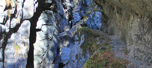
2A view of the gorge
To reach this point, you must make a short detour to the left. From here you can enjoy a view over the gorge as a whole. The riverbed is broader in some parts, while in others the waters flow within a very narrow canyon. You can grasp the different morphologies linked to the erosive action of the torrential waters and how these would have carved their deep passage in the rock. At this point, to make your way back up the gorge you have to go back along the main itinerary.
-
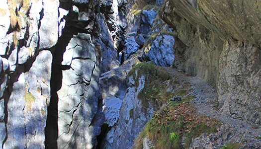
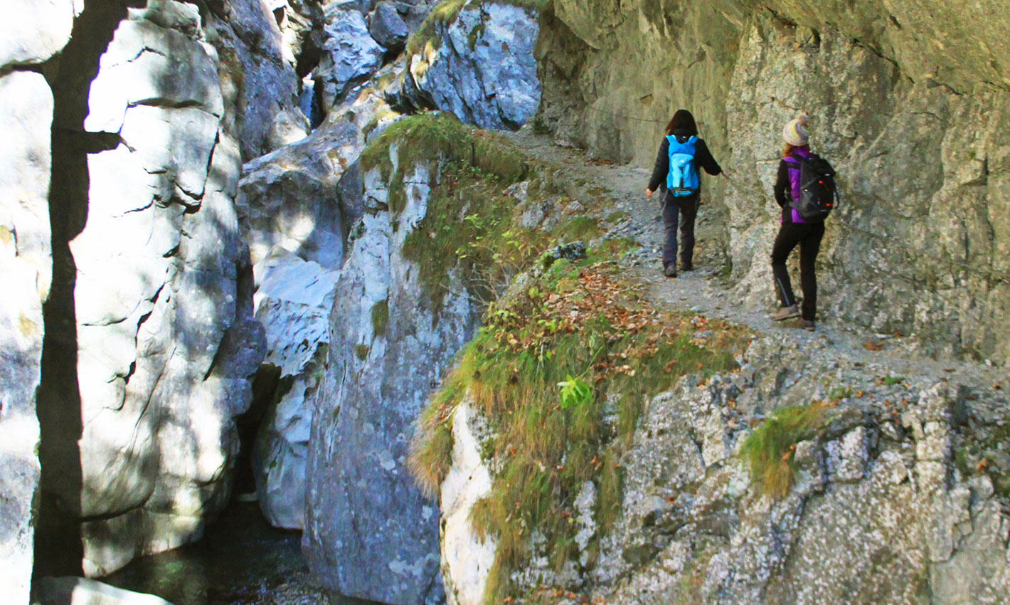
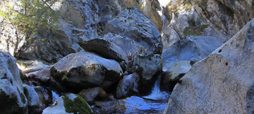
3The mouth of the gorge
Having reached the beginning of the path carved into the rock, in the middle to lower section of the gorge walls, you can see the morphologies derived from torrential erosion including smooth walls, erosion pots, undercuts, pools and falls. These morphologies are found along the entire path of the ascent of the gorge. The outcropping rocks are grey, pink and hazel-brown limestones with rare dark, clayey levels. The fossil remains of ammonoids are rare.
-
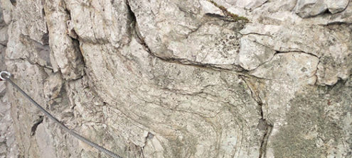
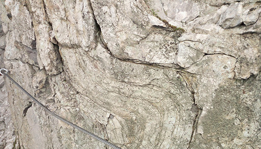
4The folds in the rock
At this point, and along the entire gorge, the consequences of the strong compressions linked to the two orogeneses, the Hercynian (in the Upper Carboniferous) and the Alpine, still ongoing, are evident. As you walk within the gorge, in fact, you can observe numerous folds and faults in the rock, which, however, has not lost the characteristics it acquired during its deposition. The geometry of the faults and folds allows us to determine the orientation of the thrusts that gave rise to them.
-
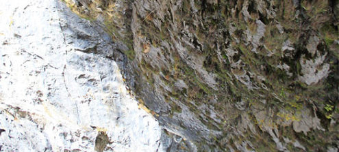
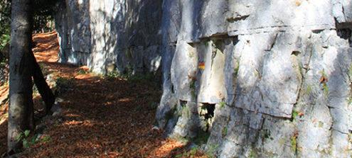
5Different lithologies in contact with one another
From this point the contact between the two different lithologies is obvious. These are the deposits of pelagic limestones mainly from the Upper Devonian and those of the lower Carboniferous, (350 to 320 million years ago) of the of the Hochwipfel formation. The latter consist of sediments of continental origin (siliceous sands and clays). The presence of Hochwipfel rocks will be even more evident further along the route, up the slope after leaving the ravine.
-
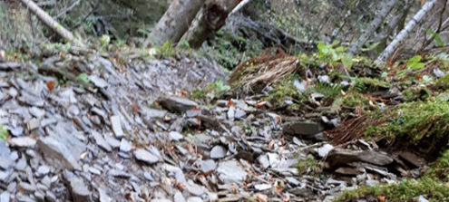
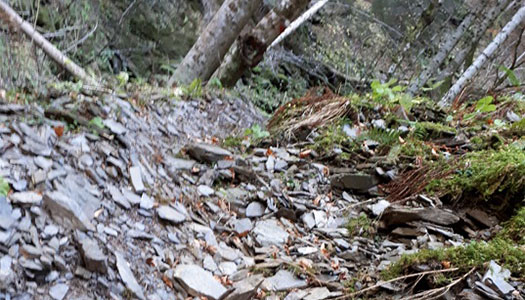
6The Hochwipfel formation
During the Hercynian (the Upper Carboniferous) orogeny, the Carnic basin was characterized by strong tectonic movements that led to the deepening of some areas and the lifting of others. Submarine landslides thus led to the accumulation of sediments with variable granulometry including breccias, conglomerates, sandstones and pelites with characteristics that indicate that they came from areas some distance away from the deposition basin. These rocks make up the Hochwipfel Formation. In this outcrop one can note dark argillites and siltites, easily flakable along parallel planes.