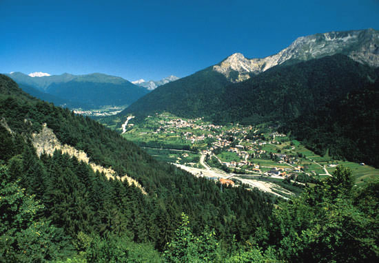
Arta Terme
The Monte di Rivo and Campanili del Lander Geotrail
BackAlong this route you will be able to observe aspects linked to landslides, erosion and the accumulation of debris. Moreover, you will be able to enjoy the sight of a very unusual and evocative landscape in the area of the Lander. From the centre of Piano d’Arta, follow the road that leads to Alzeri, crossing the Rio Randice and, at the Maina Madonute wayside shrine, turn right onto the track that climbs the left bank of the river Randice as far as the start of the CAI path 408 (about 250m further on). From here follow the path.
The route crosses the Rio Randice alluvial fan (a Geosite) and the western slope of Monte di Rivo until it reaches a viewpoint that looks out on the detachment niches of the palaeo-landslide which affected Mounts di Rivo and Cucco (a Geosite). Along the way it is possible to observe (on the right bank of the Bût) a third geosite: the Bellerophon and Werfen Formations along the Bût Torrent.
Information
- Difficulty:
- Easy
Moderate - Length:
- 4,2 Km
- Min altitude:
- 560 m
- Max altitude:
- 1260 m
- Difference:
- 700
- Season:
- From April to November
- Recommended equipment:
- Boots/training shoes, suitable clothing, water
Attachments

Information
info@geoparcoalpicarniche.org
+39 0433 487726
Tolmezzo (UD) – ITALY
-
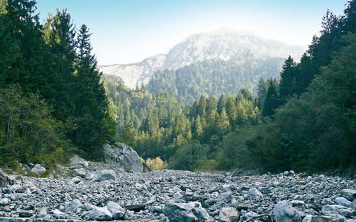
1The Rio Randice alluvial fan
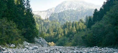
Up to the start of the CAI path 408 you are walking on an alluvial fan that has been forming for 5000 years. It consists of materials eroded from Monte di Rivo and then transported and deposited by the Rio Randice in the area where it flows into the Bût torrent, above what remained of the ancient accumulation of the Monte di Rivo and Cucco landslide. Its development has brought about the displacement of the course of the Bût towards the slopes of Monte Dauda, causing erosion phenomena on the right bank close to the bridge for Noiariis and at the locality of Araseit (a Geosite). This has exposed the passage between the Bellerophon Fm. (from the Permian) and the Werfen Fm. of the Triassic, that is to say, the transition from the Palaeozoic to the Mesozoic.
-
2The cutting of the Rio Randice into its own alluvial fan
While crossing the Rio Randice the walker can observe that it no longer flows on the surface of the fan, but has eroded the materials it had deposited itself. The stream flows in an incision that deepens towards the valley, creating slopes up to 40 m high. This is because - following the stage of deposition and formation of the alluvial fan (beginning in the Middle Ages) - an erosive phase began that is still continuing. Along the incision some groynes have been placed that serve to decrease the slope of the riverbed, thus reducing the speed of the waters and their erosive power.
-
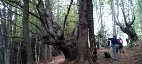
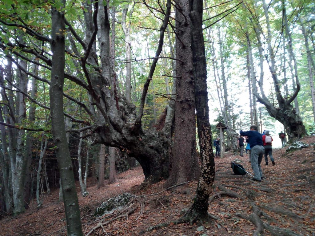
3The vegetation changes suddenly
Near the hairpin bend at an altitude of 1092 m a.s.l you can note a sudden change in the vegetation. From dense spruce forest (lower down, sweet chestnut is also present) to sparse woodland with a range of species. The ground on which the path itself runs changes and from soft ground it becomes covered with debris, a situation brought about by a change in the lithology. From the where path sets off to the Lander Bivouac, you are walking over the Werfen Fm. This formation is subdivided into different “members” and here we pass from the Campil Member (of fine sandstone and laminated red pelite) to the Val Badia Member of bioclastic micritic limestones and weakly marly limestones.
-
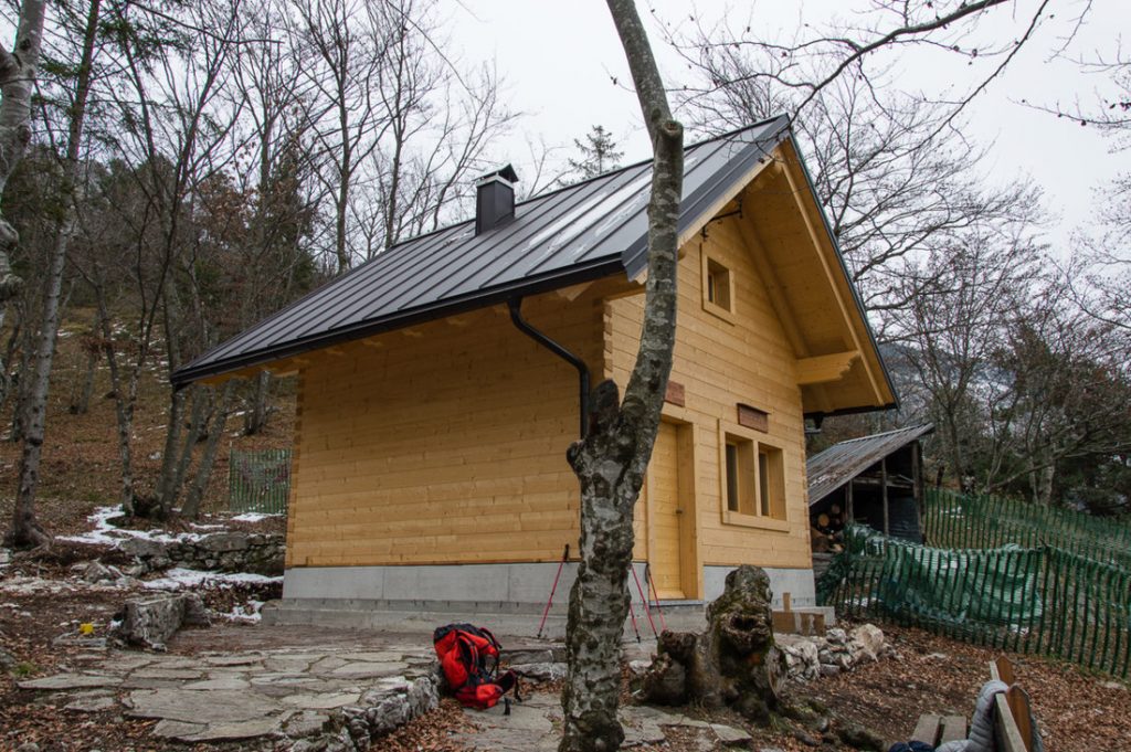
4Karst phenomena near the Lander Bivouac
The Lander Bivouac is located on a small plateau at about 1175 m a.s.l. Near the bivouac there are limestone rocks belonging to the Val Badia Member of the Werfen Formation. Here, pay close attention to the various surface morphologies linked to karst phenomena. One can observe both medium-sized forms (dolines, or sinkholes) and small-scale ones on individual blocks of rock (grooves, furrows, clefts). From here, looking south, on a clear day you can see a part of the Friulan plain, the lagoon of Grado and Marano and the Adriatic.
-
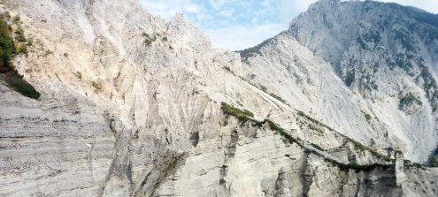
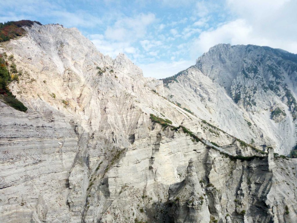
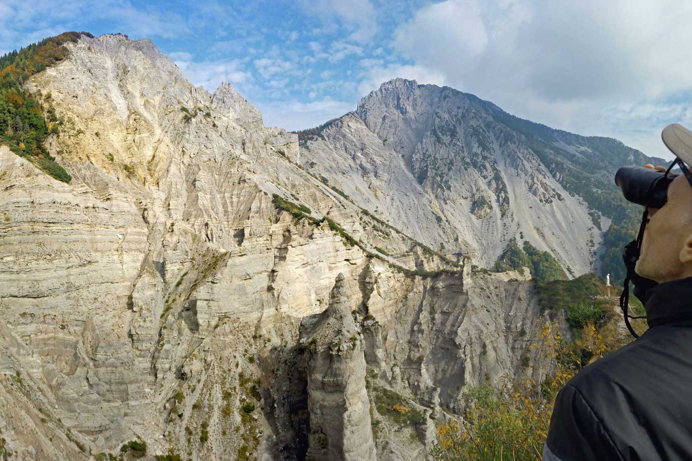
5Palaeo-landslide niches of Mounts di Rivo and Cucco- and the Lander Campanili
From here, the observer can closely examine the detachment niches left behind by the palaeo-landslide (50 million m3) which, about 10,000 years ago, affected the southern slopes of the Mounts di Rivo and Cucco. The material poured into the Bût valley, blocking it and creating a lake. The two niches are different. That of Monte Cucco is stabilized and now mostly covered by vegetation, while that on Monte di Rivo has been affected by intense erosion phenomena (still in progress) and runoff that have created unusual morphologies in the form of pinnacles and rock towers ( the Lander Cjampanii or “belltowers”).