Zoufplan: marine deposits and glacial lakes
BackThis geotrail is laid out on the slopes of Monte Zoufplan and lets the observer examine the transition between the Dimon Formation, dating back to the Carboniferous and the Val Gardena Sandstones Formation dating to the Upper Permian. The Dimon Formation consists of deep sea sedimentary deposits in which volcanic eruptions took place, with outflows of basaltic lavas.
The contact between these two formations, visible today, represents a geosite of national interest which takes the name of the “Hercynian Discordance at Monte Zoufplan”. This discordance or discontinuity is due to the uplift and erosional phenomena undergone by the rocks of the Dimon Formation during the Hercynian Orogeny, which preceded the deposition of the sediments that gave rise to the Val Gardena Sandstone Formation.
Along the entire route you can appreciate the morphologies due to the erosive action of the glaciers over the last two million years, particularly in the basin that holds the Zoufplan lakes, whose regular shape is also conditioned by the presence of various systems of faults.
Information
- Difficulty:
- Easy
Moderate - Length:
- 4,4 km
- Difference:
- 550 m
- Season:
- April - September
- Recommended equipment:
- Hikinn boots, mountain clothes (the site is vry windy and temperatures can be low even during summer), water (no drinking water available along the route)
Attachments


How to use the map
The interactive altitude map allows you to visualize, on the geographic map, the variation of the altitude of the trail as it develops; drag the map from left to right to see the direction in which the trail must be followed.It is possible to change the size of the zoom by clicking on the buttons in the top left-hand corner, while the center button allows you to restore the initial settings; finally, you can choose a different map by clicking on the button in the upper right-hand corner.
-
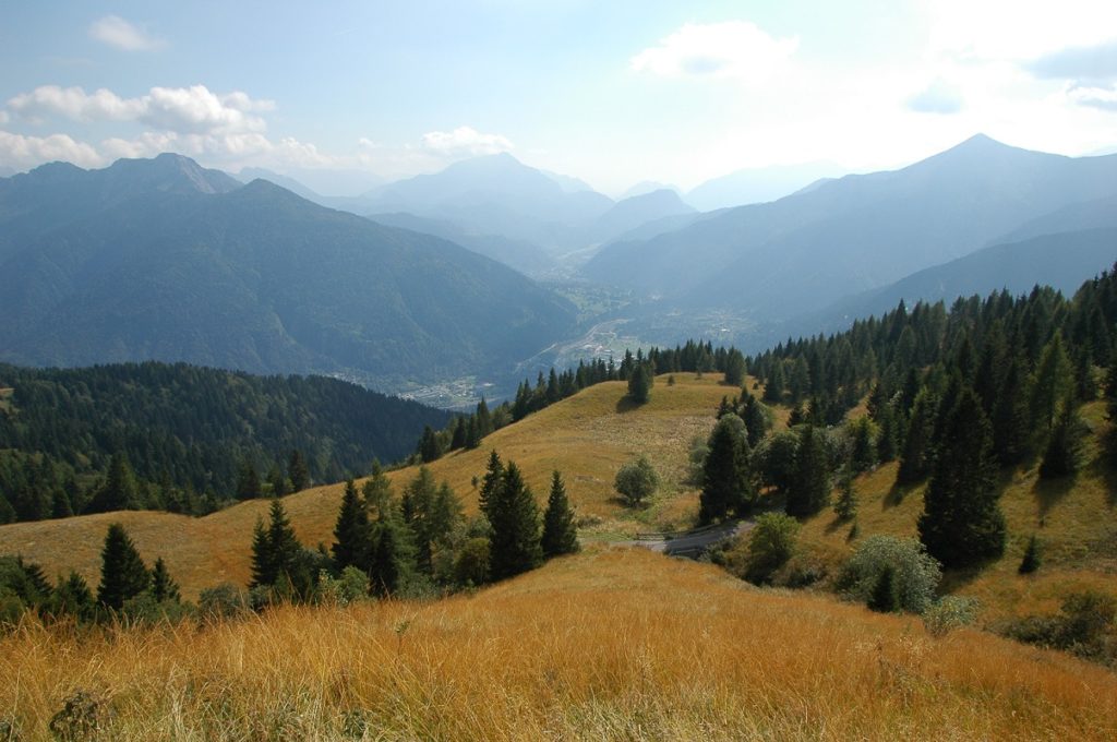
1The Piano delle Streghe (lit. ‘the Plain of the Witches’)
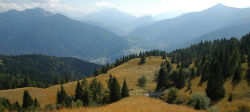
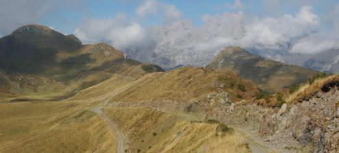
The area of the Piano delle Streghe is characterized by the presence of gentle, undulating morphologies, the result of the erosive action of the Pleistocene glaciers upon the rocks of the Dimon Formation two million years ago. These rocks, easily eroded, were formed from sediments deposited on the bottoms of ancient seas during the Carboniferous, before the entire area was subjected to the upthrusts linked to the Hercynian Orogeny which gave rise to the Palaeocarnic chain. From here there is a panoramic view across the middle valley of the Bût Torrent which allows the observer to examine several geosites from afar, including the ancient landslide niches of Monte Rivo and Monte Cucco and the cone of the Rio Randice.
-
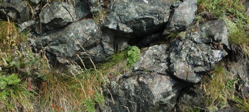
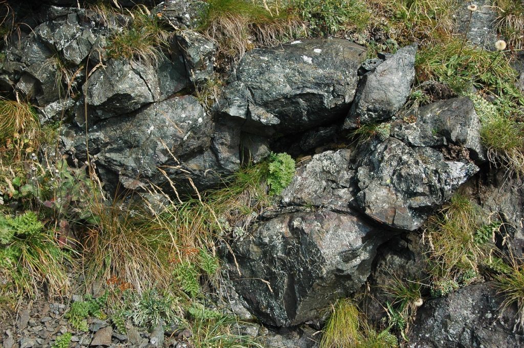
2Evidence of ancient submarine eruptions
Arriving at the point where the CAI path 154 follows the road, a detour to the right leads to the Pizzo del Corvo. A few metres to the southeast of the summit of Pizzo del Corvo are characteristic examples of basaltic pillow lavas. These sub-spheroidal forms are typical of effusive phenomena that occur in a deep marine environment. The lava erupts out onto the seabed and, solidifying, is divided into rounded blocks. This volcanic activity took place at the beginning of the Upper Carboniferous.
-
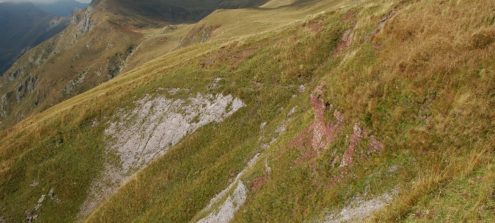
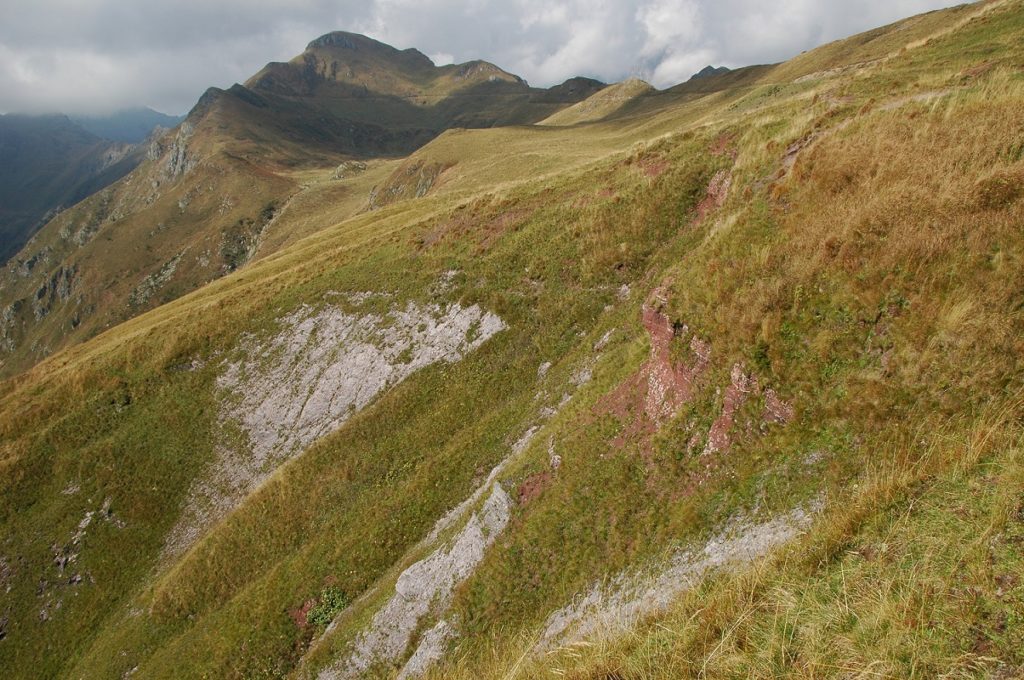
3The Hercynian Discord on Monte Zoufplan
Near the summit of Pizzo del Corvo, the plane of contact between the Val Gardena Sandstone Formation (the Upper Permian) and the underlying Dimon Formation (the Lower Carboniferous) is visible. This area is recognized as a geosite of national interest. With their characteristic reddish colour, here the pelites overlap, in discordance, with basic volcanites and stratified volcanic products. This discordance or discrepancy is a result of the uplifting and deformation to which the underlying rocks were subjected during the Hercynian Orogeny and their subsequent erosion, which occurred before the sediments that gave rise to the Val Gardena Sandstones were deposited. The discordance is also clearly visible a little further to the North-West, beneath the road near a passing/parking place.
-
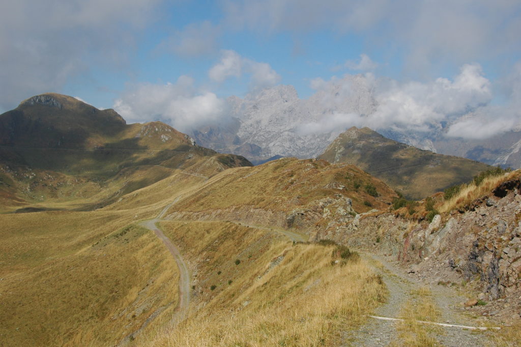
4Mount Zoufplan
At the top of Monte Zoufplan are outcrops of the sandstones and pelites of the Dimon Formation. From the top it is possible to look towards the north-west and the Monte Cogliàns group, consisting mainly of Devonian limestones. At 2,780 m asl, Monte Cogliàns is the highest peak in the Region and represents the main nucleus of the most imposing organogenic reef from the Palaeozoic visible in Europe today. Two geosites of supranational interest have been identified within the Cogliàns group: the “Devonian reef of Monte Cogliàns” and the “Creta della Chianevate, Chialderate and Monumenz: Devonian limestones, karstic phenomena and glacialism”.
-
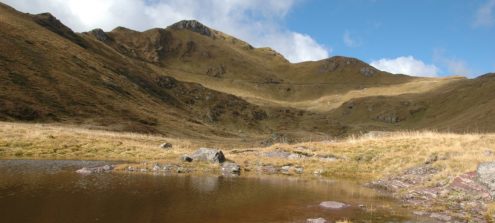
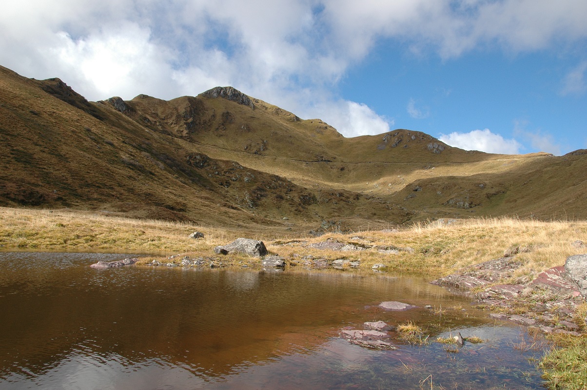
5The Zoufplan lakes and ponds
The lakes are located in a basin, the origin of which is linked to glacial erosion. Within the basin are several waterbodies, some of which have a regular rectangular or rhomboid shape. It is likely that this regularity is due to the presence of fault systems, and/or networks of fractures laid out along specific directions. Thus bands of weakness were created in the rock masses that favoured the erosive action of the glacial mass.