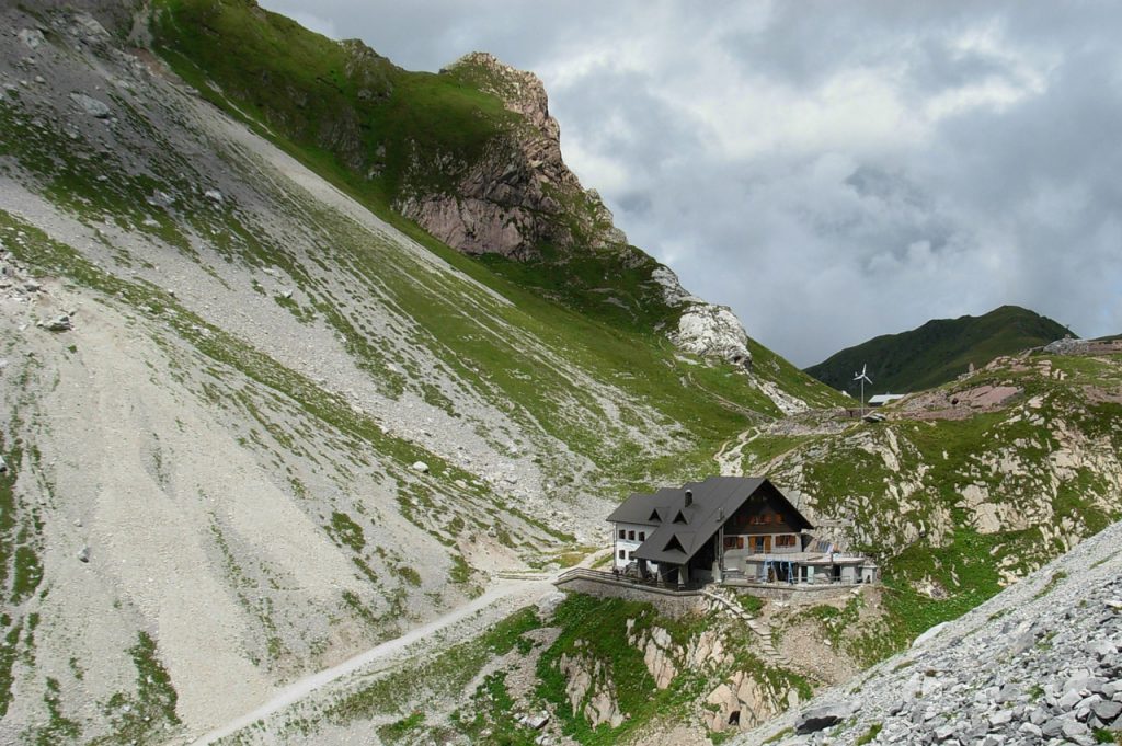
Forni Avoltri
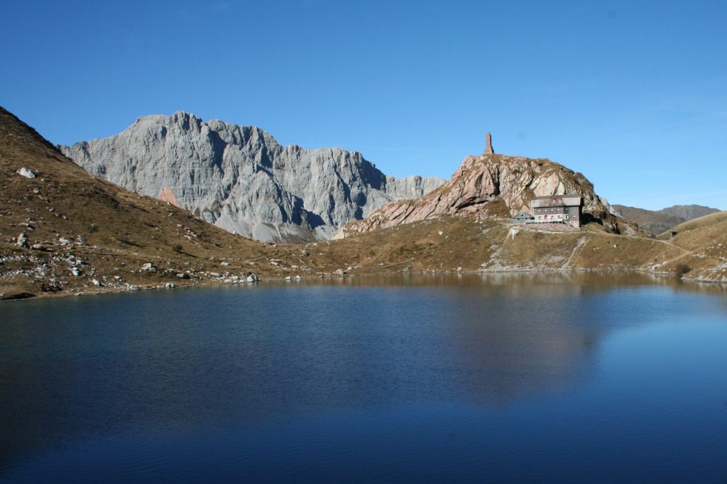
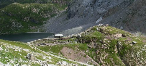
Passo Volaia-Wolayersee
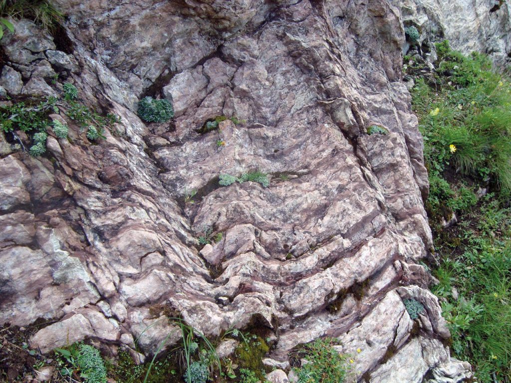
BackWorld-renowned geology at a glance
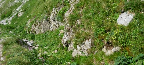
Along the “Lake Wolayer” Geotrail you will discover the remains of an ancient ocean and its fossilised inhabitants such as corals, sea lilies and squids dating back several hundred million years.
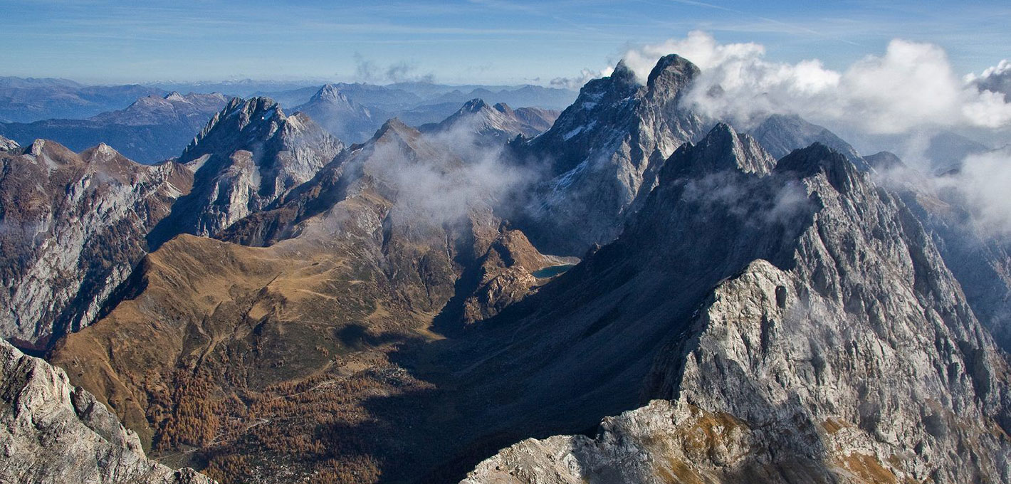
The Geotrail at Lake Wolayer takes you through a world of ancient shallow and deep seas. Because of this juxtaposition of sediment of shallow and deep seas, the Lake Wolayer area is among the 100 geologically most important regions of the world.
The ancient sea embraced great parts of Europe including the Lake Wolayer region some 460 million years ago, where it remained until 320 million years ago. It was followed by the turbulent Variscan mountain building event: some areas were lifted while others subsided.
Rocks were folded, displaced and thrust upon each other. The sea and its inhabitants disappeared. The entire Carnic and Gailtal Alps were affected by this mountain formation period. The sea returned during the Upper Carboniferous, but did not reach this area again.
Information
- Difficulty:
- Moderate
- Length:
- 4,8 km
- Difference:
- 480 m
- Season:
- June-September


Information
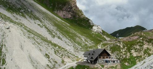
The “Lake Wolayer” Geotrail itself takes 3 hours, but the long ascent of another three hours to the starting point at the Wolayersee Hütte lodge makes this geotrail a demanding day tour. We suggest planning a two days-hiking tour. For the most part, the geotrail itself follows the much-used hiking paths no. 438 and 403; they require surefootedness but do not run across precipitous terrain.
How to use the map
The interactive altitude map allows you to visualize, on the geographic map, the variation of the altitude of the trail as it develops; drag the map from left to right to see the direction in which the trail must be followed.It is possible to change the size of the zoom by clicking on the buttons in the top left-hand corner, while the center button allows you to restore the initial settings; finally, you can choose a different map by clicking on the button in the upper right-hand corner.
-

1World-renowned geology at a glance
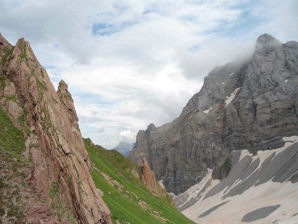
The Wolayer Valley separates in the East two entirely different realms of rocks. The bright limestone of the Kellerwand in the south formed some 400 million years ago in a shallow sea. In contrast, the colourful sandstone, the shale and the limestone of the Rauchkofel slopes in the north deposited between 460 and 330 million years ago in deeper seas. The present-day spacing between these two rock types is too narrow to be explained by natural variation in the original, very different depositional environments; only movements of huge rock masses can explain their present close proximity. These unimaginable movements brought the separate rock realms together. These rocks came together due to tectonic forces that slid along a fault.
-
2The Lambertenghi Ridge
Looking north, you can see the Lambertenghi Ridge, the ridge west of the Volaia pass that connects to the north-east corner of Mount Capolago. It represents, in some ways, a synthesis of the geological makeup of the Volaia area. A thrust fault connects two different sedimentary sequences: one is made up by rocks that deposited in an open sea over a time frame going from the Upper Ordovician to the Lower Carboniferous. Another sequence is of equal age but constituted, especially in its Devonian part, by rocks deposited in lower sea environments.
-
3A boundary between two periods: the RLF III section
The RFL III section is an outcrop of about twenty meters highlighted by a trench dug during the First World War. It is located in the basin south of the Refuge Lambertenghi-Romanin, about a hundred meters further downstream, near the path that leads to Mount Capolago. The grey limestones that emerge along the western rampart of the trenches seem equal to each other, but in reality, they contain the limit between two geological periods: the Silurian and the Devonian. This limit was recognised thanks to numerous micro-palaeontological and stratigraphic investigations.
-
4A complex structure
The Wolayer Pass is the saddle that separates the imposing limestone cliffs of Mount Capolago/Seekopf to the west from those of Cima Lastrons del Lago/Seewarte und Coglians/Hohe Warte to the east. It owes its origins to an important tectonic line north-south, a fault that cuts the cliff deposits, remains of the oldest marine environments. A fault is a fracture within a rocky body, which testifies to the movements of the block in which the body was divided. This fault is characterised by a rather important vertical movement, but also by a relative horizontal displacement which is estimated in about half a kilometre (546 yards).
-
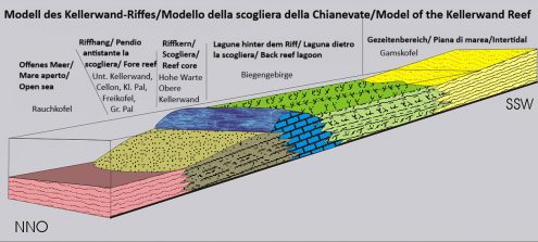
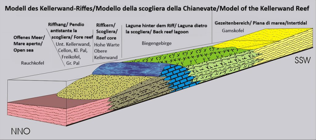
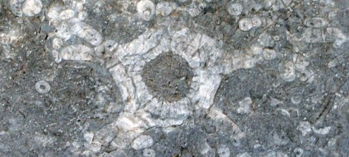
5The era of coral reefs
In the Devonian period (from 420 to 360 million years ago), a shallow and warm sea, rich in coral reefs, stretched where today we see the Carnic Alps. The curren area of the Wolayer Lake was the central body of the coral reef and its lagoon. The lagoon deposits are today the Biegengebirge chain. The Coglians/Hohe Warte and Cima Lastrons del Lago/Seewarte mountains represent the core of the cliff, consisting of limestone remains of corals, sea lilies, gastropod shells, bivalves and cephalopods. A well-preserved gastropod is visible on the boulder at this stopping point. In the surrounding debris, you can find many other fossil remains of the ancient inhabitants of the coral reef.
-
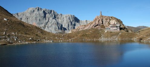
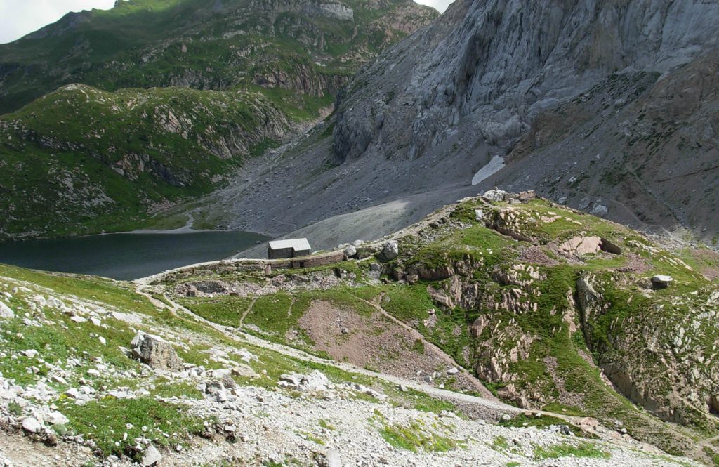
6Wolayer Lake – At the heart of marine deposits
Wolayer Lake is the result of the last ice age, the Würm glaciation, which began about 115.000 years ago. At the time, the glacier had dug the basin and then whelmed the Wolayer Pass with ice. After the ice retreat, around 10.000 years ago, the basin was filled with water, creating a lake up to 14 meters (46 feet) deep, today also fed by groundwater coming from the nearby scree.The maximum water temperature is 14°C.
-
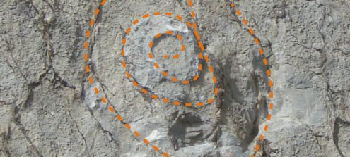
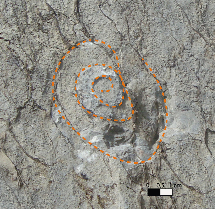
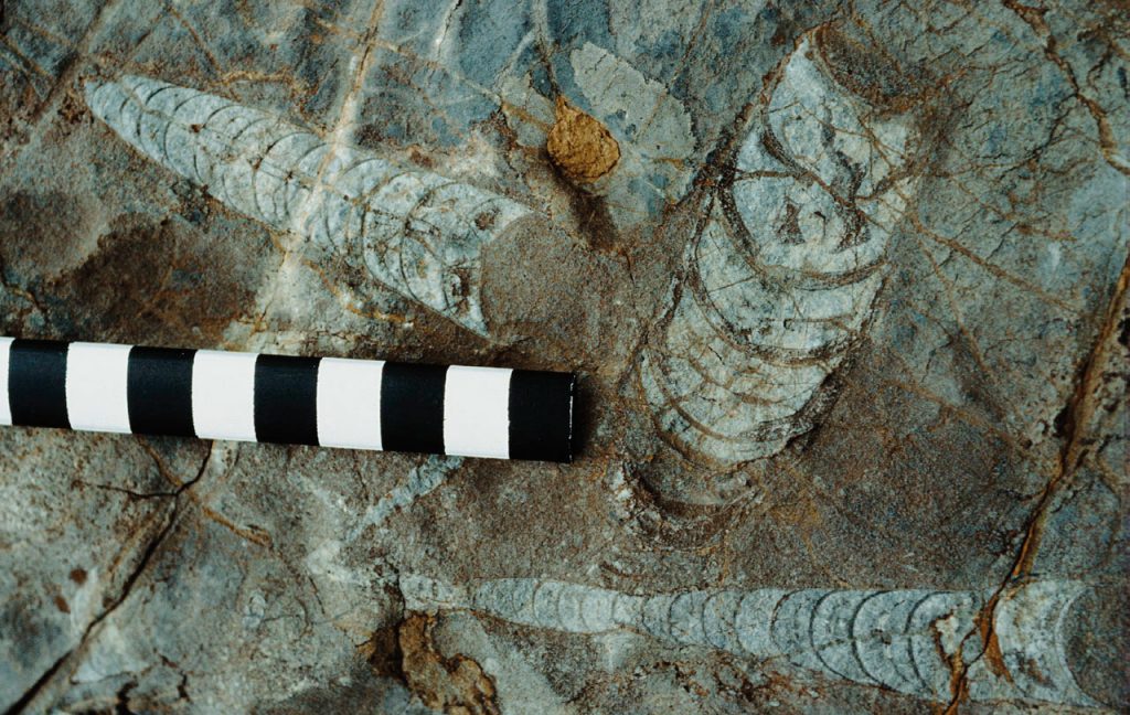
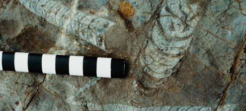
7Find beauty in the small things
Arrived to this point, we can clearly distinguish spiral-shaped fossils in the rocks: they are Goniatites dating back to the Devonian period, about 370 million years ago. These are the extinct ancestors of Ammonites. The remains of Conodonts’ teeth, unfortunately not visible to the naked eye, are geologically much more significant. The teeth are the only fossilised remains of these sea inhabitants, now extinct. They are very useful for dating the rocks in a precise way, since they have evolved in a rather short time. Despite this, the Conodonts remained a mystery for more than 100 years, until 1983, when the fossilised remain of a whole animal was found for the first time. Thanks to this discovery we know that Conodonts were 4-5 centimetres long and looked vaguely like an eel.
-

8Lifeless rocks tell of hostile times
From this point, you can see rocks that, with their 330 million years of age, are the youngest in the whole Geotrail. The rocks of the Hochwipfel Formation were formed during the Variscan Orogeny, due to the tectonic movements that caused submarine landslides, with the consequent accumulation of sediments carried by the rivers and the lowering of the sea basin. It is very rare to find fossils in the Hochwipfel Formation, due to the depositional and compositional characteristics of its rocks. This formation is the most widespread in the Carnic Alps.
-
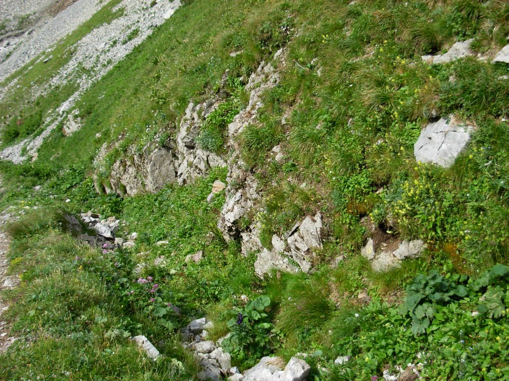
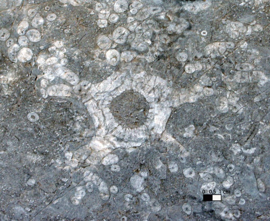
9“Bestial” flowers and other mysterious forms of life
This limestone rock comes from Mount Creta Chianevate. It is rich in Crinoids from 380 million years ago. Although their appearance makes them look like flowers, they are actually animals (Echinoderms, related to sea urchins and starfish) that lived anchored to the seabed thanks to a peduncle with roots. At the upper end, however, there was a crown, formed by a flower cup and many arms. In most cases, the fossils found are only some parts of these organisms. In addition to these, you can see corals and even the extinct Stromatoporoids, important reef builders related to sponges, but whose classification is still uncertain.
250 m far from here, in direction North-West (outside the route), you can find a big limestone rock dating back to 420 million years ago. It comes from Mount Rauchkofel und contains many fossils: Orthoceratides, whose shells were filled with calcite, and Loboliths, a particular example of the evolution of the Crinoids.
-
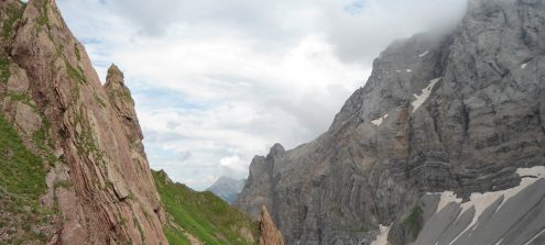
10The most impressive peaks
The mighty ramparts of Creta della Chianevate (2769 m. asl) and of Mount Coglians (2780 m asl) are the highest peaks of the Carnic Alps. The southernmost glacier of Austria, the Eiskar, is here as well. The Chianevate formed in the Devonian (415-360 million years ago), over a time span of 30 million years. The lower part of the wall has evident layers, deposited in a relatively shallow sea. On the other hand, in the upper part there are massive rocks representing the actual body of a growing reef. The fold in the middle part of the wall is related to more recent tectonic movements. To the north, the reddish rock of Mount Rauchkofel is typical of open sea deposits.
-
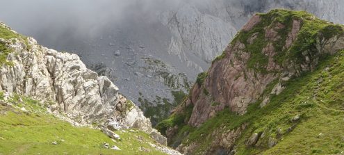
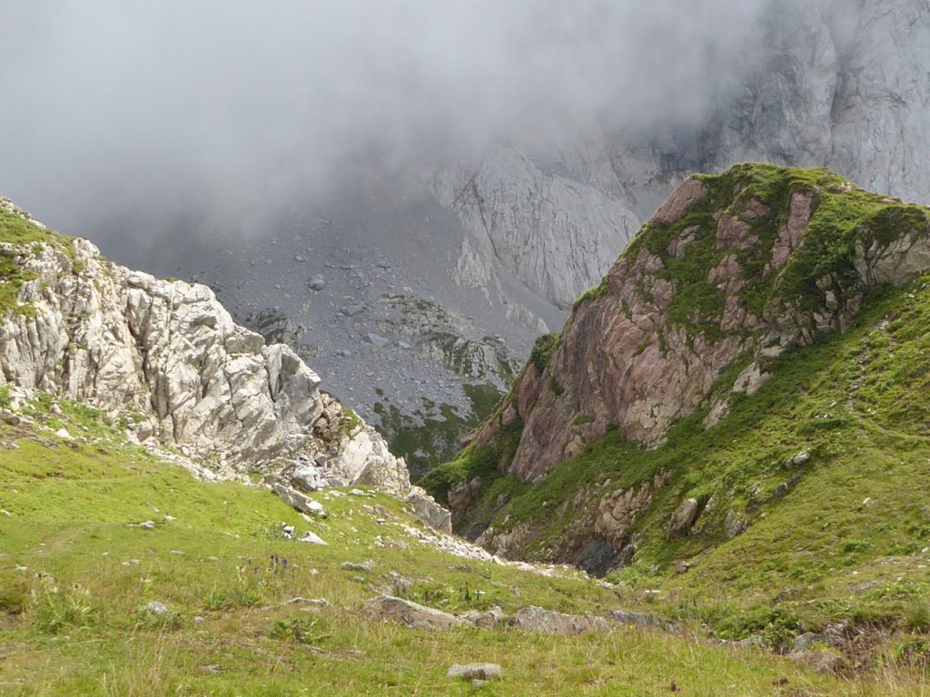
11Mountains in motion
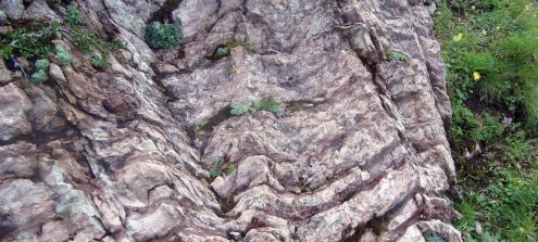
Upon arriving at this stopping point, we can cast a glance at our shoulders and easily sense what immense forces are acting in nature. The clear limestone of the Wolayer Formation, on the eastern side, does not continue in the valley, where the limestones of the Findenig Formation can be found. The rock sequence was strained by tectonic movements, which have caused the layers’ slip. These movements have fractured the rocks, thus exposing them also to the erosion: therefore, it is frequent that valleys form along areas affected by tectonic lines (faults and/or overthrusts). The Gail Valley itself represents a stretch of one of the longest tectonic lines in Europe, the Periadriatic one, which extends for 700 Km (434 miles).
-
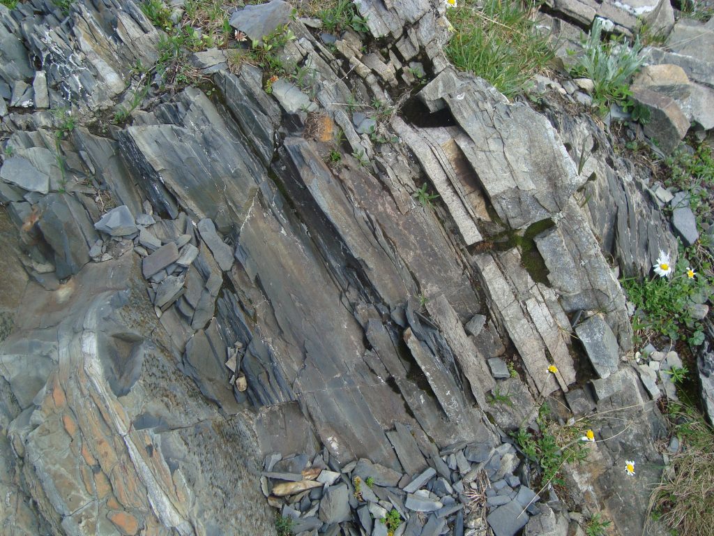
12Witnesses of a deep sea
The brown deposits of the Mount Cocco Formation attest to an open sea expanding here about 430 million years ago. These deposits show incrustations of iron and manganese and are rich in orthoceratids (cone-shaped shells). A completely different type of rock emerges about 25 meters to the South-West: the blackish schists of the Bischofalm Formation. These outcrops are composed of siliceous rocks and deposits of a calm and deeper marine basin. The Silica derives from radiolarians, tiny unicellular organisms. The little presence of currents in the deposition sea basin has resulted in a shortage of dissolved oxygen in water; for this reason, the organic material deposited has not decomposed but accumulated in the rock in the form of carbon.
-
13On the most ancient rocks
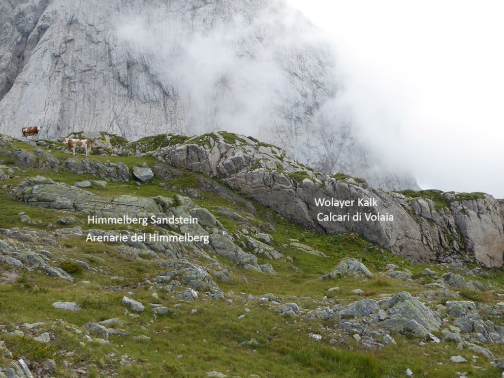
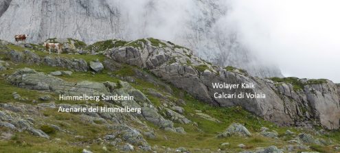
Here you can see the oldest rocks of the Geotrail: the Himmelberg-Formation sandstone and the Wolayer-Formation limestone. Both deposited during the Upper Ordovician. The first one, grey-green represent fluvial-deltaic deposits, poor in fossils and mainly composed of quartzes. The grey rocky ridge on the southern side is younger and rich in marine environment fossils. You can distinguish sandstones from limestone because of the plants covering these rocks. They are mainly Rhizocarpon geographicum, a lichen that prefers siliceous soil (sandstones).
An interesting point is 100 meters far from here, in direction South-West, outside the route. There is a trench dug during the 1st WW. The grey limestones of the Wolayer Formation are in direct contact with the red ones of the Cocco Formation. The former are around 450 million year old, the latter 430. The sediments deposited in this time span are therefore missing. This lack is probably due to a lifting of the sea floor and an almost simultaneous lowering of the sea level during a glacial phase. The Cocco Formation rocks are rich in orthoceratids. In the Limestone of Volaia there are many fossil remains of peduncles and arms of cystoids (similar to sea lilies).
-
14The limestone of the Findenig Formation
The limestone of the Findenig Formation was formed from a calcareous mud rich in clay, which was deposited in deep seas during the Devonian, about 390 million years ago. It contains mainly shells and skeletons of microorganisms (plankton). In the rock, dark red clayey layers alternate with lighter layers in which limestone predominates. The red colour is due to their ferrous mineral (hematite) content.